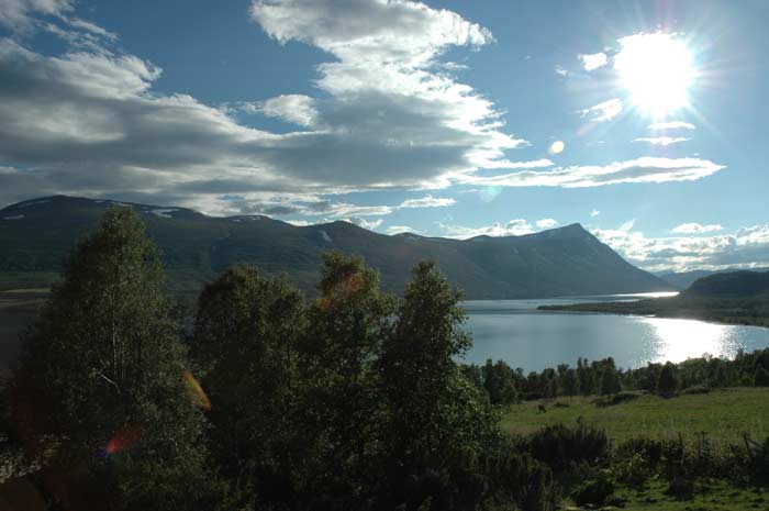
We wake up to a wonderful, clear and sunny sky. The clouds have cleared to reveal the deep blue sky. We get a pretty early start this morning. Our plan is to reach our jumping off point in the Trollheimen mountains and begin our hiking in the afternoon. We have our breakfast, pack up and are on our way well before 10 AM. We make our way down the rest of the way to Åndalsnes, where we briefly stop to check our email.
From here we make the long circuitous drive around the Romsdalsfjord and along the Langfjord. We have some spectacular fog along the Langfjord. The fog covers the water and every once in a while we can see a ferry or other boat emerge from the swirling clouds. It is amazing how long a drive can be to cover the path a crow could fly in such a short time when tunnels and ferries are not used to get around the bodies of water and the mountains.
After traversing the length of LangFjord, we make our way across to Tingvollfjord, where we turn east and make our way to the end of this fjord. At Sunndalsøra, we fill up on petrol and get some groceries. Then we begin our drive into the valley of Sunndalen, which flanks the Trollheimen mountains on the south. The valley has some steep flanking mountains that keep us penned in as we drive up the valley. At one point where the valley gets very narrow, we can see where three farms and 32 people were swept away in an avalanche. Now the farms are built under an overhang so the snow will slide above them.
At Festa bridge, we turn north off of route 70 and enter a toll road that takes us to Gjevilvatn lake and the famous Gjevilvasshytta which will be our jumping off point for our few days of hiking. We get there at about 1:30 PM and our first priority is lunch. Once we have had our picnic lunch, we begin the process of sorting out our stuff that we will take with us on this hike. As we will be camping out a few of the nights, we need to bring our tent, sleeping bags and therma-rests, in addition to the food and clothing. As we are hiking in Norway in the mountains, we have to bring gear that will prepare us for quite a range of weather conditions, from hot and sunny to cold and rainy/snowy.
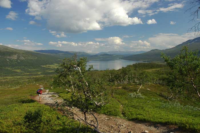
After buying a hiking map from the hut and getting some information on where we are going, we lock up the car and begin our walk. We have decided to try to target a certain spot where we will camp that is about half-way between here and another hut deep in the mountains. We leave at 3:30 PM. The goes for a short distance along the northern edge of the Gjevillvatn lake, then turns north-west and heads up the eastern bank of the Gravbekken river, which is at the bottom of a shallow valley.
As we make our way further and further up into the mountains, the terrain becomes more and more dramatic and stunning. At this point the walk, despite going uphill, is not too strenuous and we make some good progress. The trails are the typical Norwegian ones - kept natural with small cairns and red paint markings to mark the way.
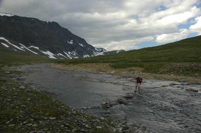
After we pass the confluence with the Tverrbekken river, we have to begin to look for a place to ford the river. There is quite a bit of snowmelt that has filled the river and we need to look for a wide spot in the river where we cross safely and without getting to wet. At first it looks like we will have to get our feet wet, but after a bit of scouting, we are able to find a route across the river that allows us to hop from rock to rock. While this does slow us down, we do not have to get our feet wet.
It is now after 6 PM and we start to think about a place to camp for the night. We would like to find a source near water, but which also dry and flat. We had been told that a bit further on from here, there are a couple of small huts that we can use if we wish to. While we are not sure we want to stay in the huts, we decide to make our way in that direction.
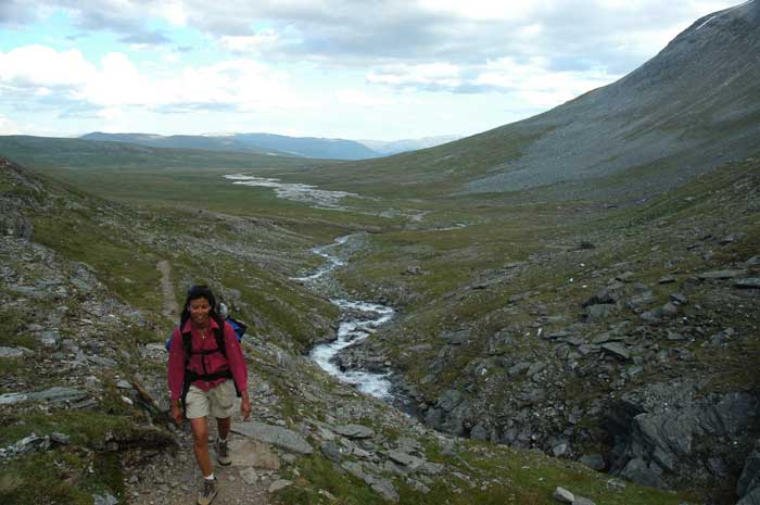
We traverse along the lower slopes of Blåhøa, which rises steeply to our right. We are now entering a valley or saddle that is narrow with steep slopes on each side. It is very dramatic and the temperature has dropped as the sun is blocked and the cold air rushes down the valley. Soon we have a small, steep ridge to climb, that takes it's toll on us. We are now getting a bit tired and are ready to camp for the night. We are just starting to break in our hiking muscles. We are now in the Kamtjønnin area, with it's two small lakes. We make our way around the northern edge of the smaller one, crossing wide shallow streams with rocky bottoms and after one more ridge find ourselves in a good camping area.
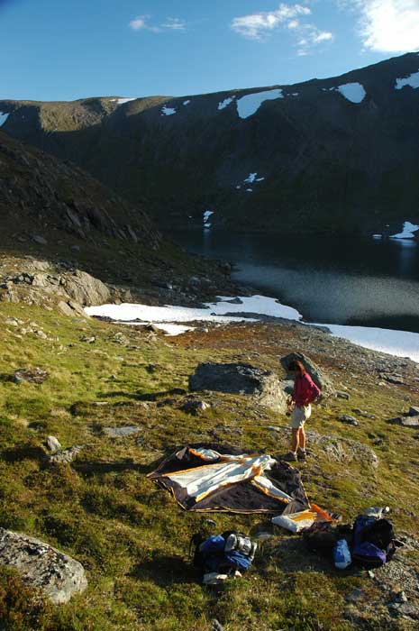
It is actually very difficult to find a good spot to set up a tent. While certain areas may look flat and smooth from a distance, up close it is hard to find a level surface with no rocks and that is dry. After some scrambling here and there, we find a very nice spot that is even hidden from the trail. We have a bit of seclusion and privacy. The weather is now looking a bit threatening with dark clouds and the sound of thunder, so the first priority is to set up the tent and have it ready to take our gear and us should there be sudden rain.
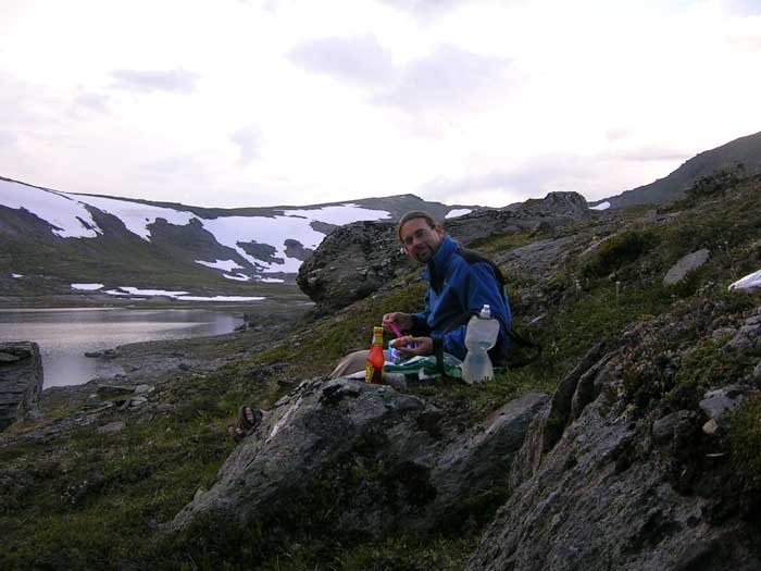
Once we have our shelter built, we fill up our water bottles from a nearby stream where the water tumbles over some rocks and then have some dinner. As we wanted to travel light, we are not carrying a stove and pots with us. So, it is a cold dinner. We have brought with us some tuna in foil packets (rather than the usual tins) and we make some tuna sandwiches. We have mayo and chili sauce to make it a bit more tasty. We have found a nice little rock outcrop behind our tent that can serve as a windshield, seats and table. A great spot.
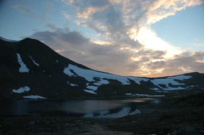
By now, the temperature has begun to drop. The sun has pretty much disappeared, there is some cloud cover and we are at about 1,200 meters above sea level. Here in Norway, so close to the Arctic Circle, this is a high elevation and the temperature can drop significantly at night. So, after a wee dram ( we did not neglect to bring with us our hip flask with some of the single malt we collected in Scotland), we retired to our tent. After a quick wash, we snuggled up in our sleeping bags to keep warm.
The rest of the evening is spent doing some stretches, reading and munching on a large bar of chocolate. And then it is time to head off to sleep. It is really great to be out here in some of the most beautiful country in the world. And there is no one else around us. We have it all to ourselves. So beautiful, so isolated and so invigorating.