We wake up to another beautiful day. We find it hard to believe that the sunny, hot, summer weather is holding so long. This is Norway after all!!! The sky is clear, blue and sunny and it will be a hot one. Even early in the morning with the pre-dawn chill in the air and the sun behind the high surrounding mountain peaks, we can feel it. We have a bit of a slow start, enjoying the warmth of our sleeping bags.
But soon we must rise. We have a long day of hiking ahead of us. We reluctantly get out of our sleeping bags and emerge into the day. We pack up our stuff and have breakfast. After filling our water bottles and last minute preparations, we are ready to go. We head off shortly after 9:30 AM. While the start of our hike is a flat traverse along the side of the slope, we have already spotted the steep slope that rises up to the ridge top at Riarskaret.
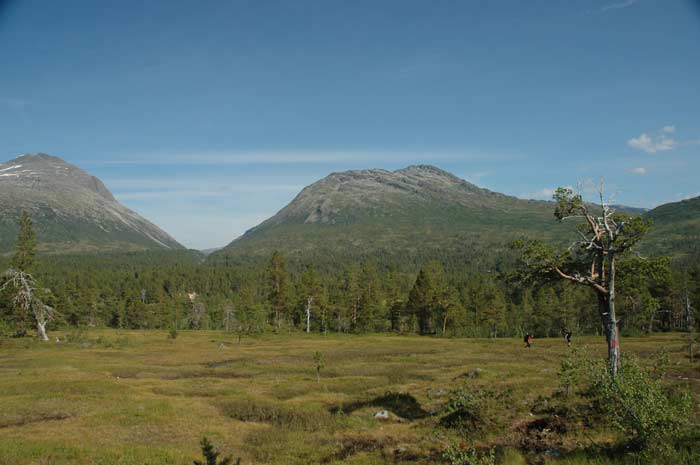
Our approach to these steep slopes is to just attack them, just that Lars does it at a faster pace. We put our heads down and tackle the steep path step-by-step. It is better to keep up an even, steady pace, than to have frequent stops. In the end, from our camp, it takes us 30 minutes to reach the top of the ridge and we are rewarded with some stunning views on this clear day.
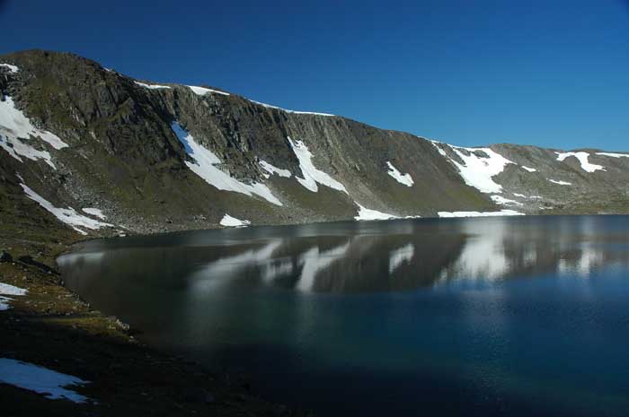
In the immediate foreground is the Fossådalsvatn lake and Mellomfjellet. Right behind it is our goal tomorrow - Snota, a very distinctive mountain standing all by itself towering over the valleys and lakes below it.
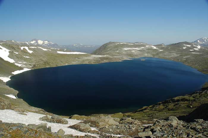
From here we can also see a wide range of other mountains in the distance. Next we have the steep descent down to the lake below. Once we are at the lake we can see how clear and clean it is. Visibility into the lake is tremendous and we can see the rocky bottom disappear far below the surface of the lake. After having spent much time in polluted areas, you can see what people miss out on by spoiling their natural surroundings.
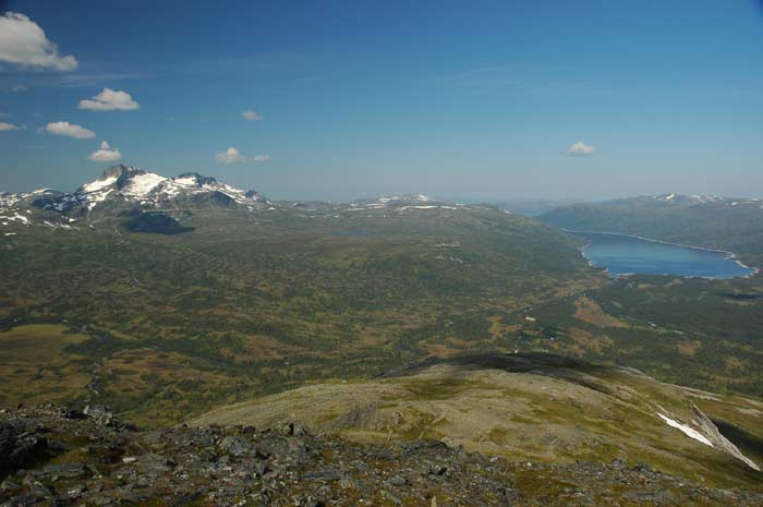
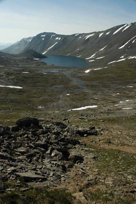
We now have a long walk along the undulating top of this plateau as we are forced by the cliff falling away on each side to the knife edge to the north. We pass by a number of small lakes fed by the snow melt and enjoy the fresh views that each ridge offers us. Finally we get to the Skåvegen ridge at 1,310 meters and, after taking in the view of our planned hike for the rest of the day and tomorrow, begin our descent to the valley below.
At first the descent is gradual, but as soon as we reach Skallen, the slope drops off as we make our way down the pointed ridge at the northern end of the Mellomfjell mountain. Sometimes the walk down can be tougher than the walk up. While the walk up is tough on the energy levels, the way down is tough on the knees and feet. With our heavy packs and the steep slope, we take a bit of a beating on our un-trained legs.
Soon we -re-enter the tree line and join up with the Slettåa river. We carry on here for a ways and then reach the point where we need to cross the river to get to the hut. It seems, however, that the bridge has either been washed out or moved and it takes us some time to find the spot where the bridge has been placed. From here it is but a short distance to Trollheimshytta. This hut was built in 1890 and has been extended a number of times.
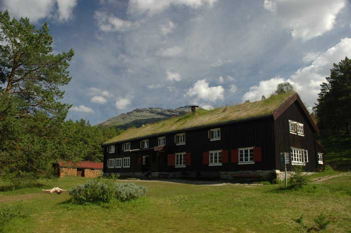
We will not stay here for the night, but rather just have a rest and some lunch. We get here shortly after 2 PM and head into the hut. They do not serve lunch, so we will have to feed ourselves from our own supplies. But we are running short of bread, so the staff at the hut are kind enough to sell us some bread. We will need this for our lunch, dinner and breakfast. After getting some information (not as useful as at the hut yesterday), we sit ourselves down outside at one of the many benches set up on the lawn. It is so hot in the sun, that we need to find some shade.
Once we have had our lunch and had a short rest laying back on the benches, we decide that it is time to head off. Our plan is to hike half-way up to the summit of Snota and camp there. This way we will have a shorter hike tomorrow and we will not have to carry all of our gear all the way up to the summit. We will establish a base camp from which to launch our assault.
So, with our stiff muscles (that is the problem with making such a long stop in the middle of the day), we hoist our packs on our backs and make our way back to the river and the bridge. Once over the bridge and on the other side, we make our way north-west along the Slettåa river. This area is amazingly swampy - there is water everywhere and the track is often heavily mudded. And it has not even rained in the last few weeks. It must be all the snow melt from the hot, sunny weather we have been having. Often we have to deviate from the trail to avoid the worst of it. This is important for us as our boots are not the best and are not very waterproof.
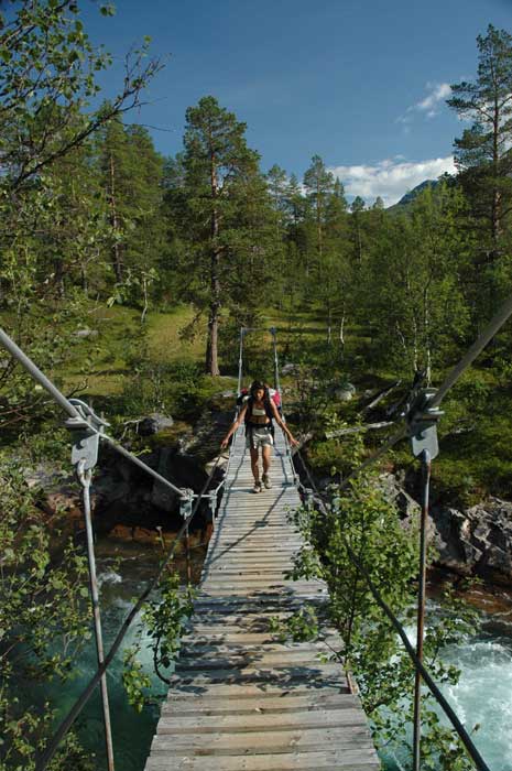
We now come upon the large, flowing Folda river. Here we are certainly fortunate that they have put up a bridge to cross this river - we could never have waded it. We cross the bridge one at a time - low railings and it really sways. And then begins the tough climb up - straight up, the ridge that leads to the plateau of Bossvasshøgda. This was tough. We are already tired form our earlier hiking, the sun is out in force and it is hot. And to make matters worse, the ground is very wet and swampy. At times we have to make long detours to avoid sinking deep into the muck.
The trail goes straight up and at times we need to use the trees as handholds to pull us up. But we head up step by step. Soon we have reached the inflexion point where the slope levels out somewhat and the going gets easier. We have now passed the tee line and there is no more shade form the sun.
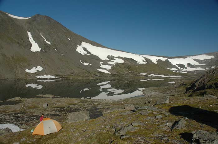
We make our way across the undulating plateau - we are covering the distance relatively quick. We pass to the left of the few lakes that dot this area and carry on. It is now nearing 7 PM and we feel that it is time to look for a place to camp for the night. While we had hoped to reach the ridge that would take us above 1,000 meters, that seems beyond us today. As it is, we struggle up the ridge before that one and decide to camp in the small valley between the ridges.
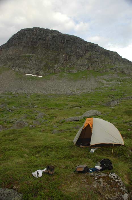
But we have a tough time trying to find a flat, dry place to pitch our tent. All the grassy places that look level are very wet and are filled with water like a sponge. In the end, the only place we can find is a small spot right next to the trail barely large enough for our tent. We wanted to be a bit further from the trail itself, but we have no choice.
We soon have our tent set up and sleeping gear laid out inside. We have filled our water bottles from the nearby streams (there are not many places in the world where you can still take your water directly from the streams and rivers and drink it). It is now time for dinner. Well, once again, we have our dinner of tuna. A bit boring, but it fills us up and gives us energy.
At about this time, the bugs start to appear, so we decide to retreat into our tent. Not much fun having to keep swatting at them. Once in our tent, we have our quick wash (using our no-rinse body wash - great stuff), and settle into our sleeping bags. We read some and enjoy another bar of chocolate and a wee dram from our hip flask.