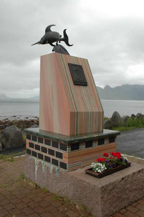
The weather does not start out too well, so we have a slow morning taking our time having breakfast and getting ready. But at 11 AM, we feel it is time to head on. After a short drive we make a brief stop at the monument that commemorates the crew of the submarine "Uredd", which was lost off these shores during the Second World War. It had quite a diverse crew of men from various parts of the world.
We carry on, taking the road that makes it's way along the coast. As usual, a bird could cover the distance in a fraction of the time, but the broken coast line dictates the route of the road that we have to take. We pass through a number of towns and the come to the first of two tunnels. It is 1,900 meter long Fyken Tunnel. We emerge for a short stretch and the road soon disappears into another tunnel. But we pull off the road here and go in search of some of the oldest rock carvings in Northern Europe.
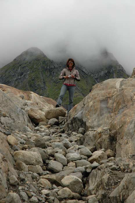
We pull off onto the road that branches off to Lake Navnløs (Nameless Lake) and after a short distance park our car. Now we need to find the carvings. There is nothing telling us where to go or how to find them. We decide to explore up the side of the granite slope that rises to our left. It is not an easy climb - it has been raining and the smooth rock is very slippery. We criss-cross the rock face looking for the carvings. Finally, we spot a wooden platform and we have found the location.
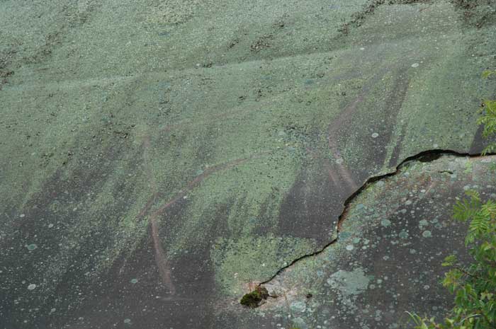
On the wooden platforms, there are some information boards which describe the carvings and where they are. But we have a really tough time finding them. Coming here has actually been a great experience as it shows us just how hard it is to spot these rock carvings. In Alta, they had painted them red, so it was easy to see. Here we are trying to pick the etchings out of the rock - and we even know where to look! It is an interesting place - and not a soul. There was no sign on the road indicating these sights are here, so if it had not been for our excellent guidebook, we would never have known to stop here.
We get back in our car and make our way back to the road and the second tunnel. Just one problem - the red light in front of the tunnel is on so we cannot enter. We can only sit here and wait - there are no alternative routes for us. After a while, two men show up in a small car and drive in (and we imagine through) the tunnel and return. Everything must have been in order, because they turn off the red light and we can proceed through the 7,600 meter Glomfjord Tunnel.
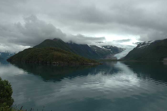
We emerge from the tunnel at the head of a completely different fjord and valley. That is the wonderful thing about these tunnels - it is as if we have been transported. We drive a short way along the fjord and soon arrive at Holand. We stop here to see if we want to make an excursion to the Svartisen Glacier - one of the few advancing glaciers in the world. To get there, we have to take a boat across the fjord and then walk about 4 km to the base of the glacier.
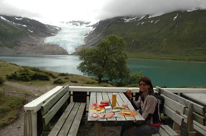
Despite the threatening weather, we decide to go for it. We have only a short wait until the next boat, the Isprins, takes us across the fjord to the other side at a place called Engen. From here we have to walk to the glacier. Our first goal is the tourist hut set up at one end of the lake - the walk there is nothing special, but soon we are at the hut. We take advantage of the views and the picnic tables to have our lunch.
After about half an hour, we decide to take the left hand path around the lake to the glacier. This is a much nicer walk, with the lake on one side, the steep mountain face on the other and in front of us the saddle with the glacier pouring down it like sticky molasses. There are are plenty of glacier fed streams and rivers cascading down off the mountain face.
Then we come to the base of the saddle, on the edge of the lake. The rocks have been rubbed bear by the relentless power of the tons of ice that have ebbed and flowed down this slope. The forces of nature as exhibited by the glacier are incredible.
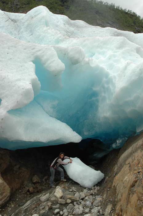
The trail is harder to follow here - just the occasional paint stripe on the bare rock. We want to get as close to the glacier as possible and we make our way across the barren slope. Soon we come upon the glacier itself. We are fortunate - we have found a spot where a small cave has formed so we can see the deep-blue ice inside.
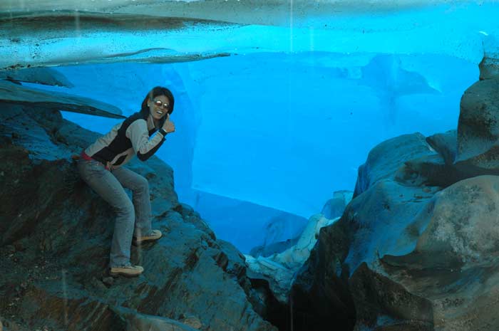
We carefully take turns briefly going inside the small cavern to experience the lights, sounds and coolness inside the cavern. We have the melting ice constantly dripping around us. There is the feeling that you can hear the ice grinding against the rock - but this must just be our imagination as we make our way under thousands of tons of ice hanging over us. The light has been turned a deep blue as it is filtered through the thick ice mass. And we can feel the coolness of the air, cooled by the massive freezer all around us.
It is a great experience. We are sad to leave this place, but we need to make our way back to the boat pier. The schedule is limited and we would have to wait an extended period of time for the next boat. We have an easier time finding our way back to the trail as we can now see where we need to get to. We have a very pleasant walk back through the forested trail. Much of this area is still one or more working farms and there are plenty of sheep wandering around in the forest. We pass by the tourist center and carry on to the boat pier. We get there with time to spare and wait for the boat to depart.
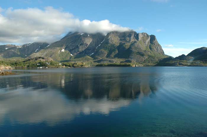
The ride back is short, but nice, and once back in our car we fill up our water supply at the nearby tap provided for camper vans and then carry on our way along Route 17. The view across the Holandsfjord to the Svartisen Glacier and the 1,454 meter high Helgelandsbukken is marvelous. Just sorry that we do not have clear weather. We have a number of ferries to catch - we want to try to reach the Arctic Circle and Kilboghamn this evening.
Once we get to Forøy, we have about a half hour wait for the ferry. The ferry M/F Bogøy takes us across the narrow strait in about ten minutes to the town of Ågskardet. We now carry on around the Tjongsfjord on our way to Jektvika where we will catch our next ferry. We arrive in plenty of time for the next ferry - the schedules do not seem to be that coordinated as we often seem to have plenty of time (or no time) to get from one ferry to another on one road network.
Anyway, we have almost an hour to wait. We just hang out and relax. We watch the smoke rise into the sky from the bonfires set to celebrate the mid-summer nights eve. We are sorry that we are missing the parties, but they are located off the road and we would not know how to get there. As we sit here waiting for the ferry, we see how fast the weather can change in Norway. When we arrived, the mountain tops that surrounded this bay were covered in clouds. By the time we had boarded the ferry, the clouds had largely blown away, leaving a clear, blue sky.
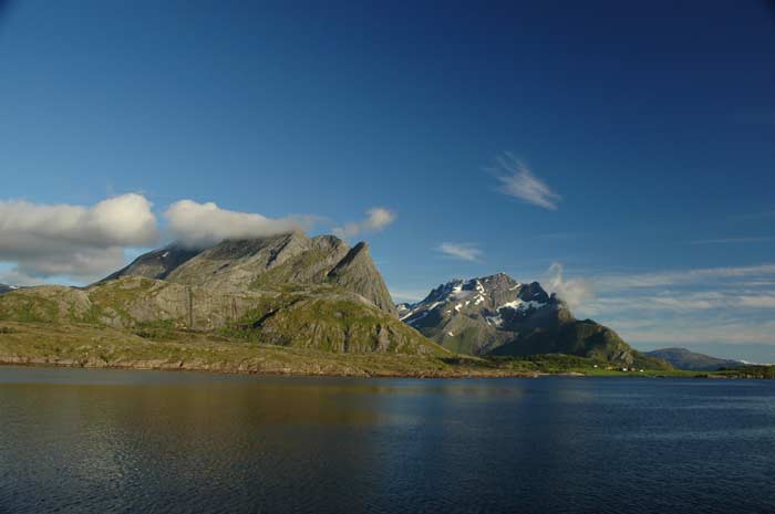
This ferry ride takes about an hour and it is a pretty spectacular one. One one side we have the mountains jutting up from the mainland, green at the base and then smooth, grey rock rising up in great, smooth sheets. On the other side is the sea, broken up with islands with with strange rock formations and mountains. The famous Hestmannen at 569 meters rises to the east.
The sky has cleared, so we have an excellent view as we make our way across the fjord to the other side. At the mouth of the Melfjord, the ferry crosses the Arctic Circle - we are sorry to leave the land of the midnight sun. We arrive at Kilboghamn at 9:20 PM. It is time to find a place to stay for the night. Our information indicates that there is a campsite nearby, we just need to take a small detour up a side road. The site looks promising from the map - we hope to get one more glimpse of the midnight sun before we head to far south.
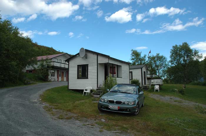
It takes us only a few minutes to arrive at the campsite - a large set-up with huts scattered over the slope of the hill, with plenty of room for tents and campervans. We get a hut and settle in for the night. First it is time for our dinner. We follow this up with a shower in the nearby shower block. By now, it is midnight, and we decide that we should go and see if we can get one last look at the midnight sun.
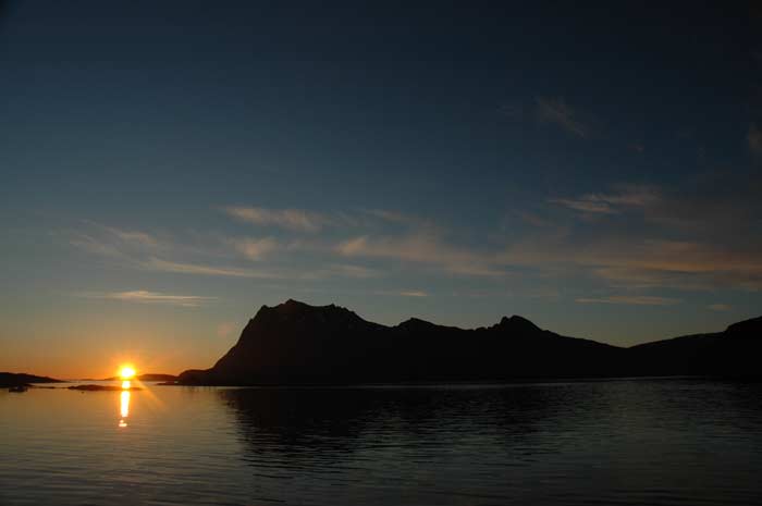
And we are fortunate. We walk down to the water's edge and sit on some rocks and watch the sun as it slowly settles in the sky, making it's way to the horizon. The barely kisses the horizon and it then begins it's slow rise, heralding another day. We are so happy - the clouds have cleared and we have been able to find a campsite right on the Arctic Circle with a clear view over the water to the horizon. After sitting there for a while and watching as the colors begin to change, marking the start to the new day, we decide to head off to bed and get some rest before tomorrow starts for us.