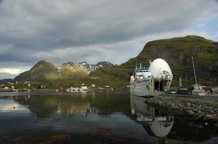
We are up early this morning as we want to catch the 7 AM ferry to Bodø. We were unable to make the last ferry that departed yesterday, so we really want to make this one. In fact, we have already parked our car in the queue for the ferry, so as long as we get to our car before they board, we will be OK. Shortly before 6 AM we get up, dress and pack up our tent and gear. We then need to carry all our stuff the short distance down to the ferry pier. Since we had dropped off the car last night, the queue has grown even longer. While we are sure most will make it on, at least we are sure that we will.
We load our stuff into the car and then have our breakfast and wash up while we wait. At quarter to seven, they start to board the ferry and we drive aboard. The ferry is ready for departure shortly after 7 AM. It takes us almost four hours to make the crossing to the mainland. It is quite a distance by boat, but it certainly saves us a long drive all the way around.
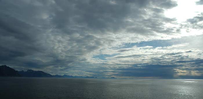
We settle into some seats and take it easy, reading and hanging out. From time to time, Lars goes up onto the deck and takes some pictures. But the weather is not that great. The ferry pulls into Bodø just before 11 AM and we drive off the ferry. This is the second time we are here - the first time we spent our visit wandering around town, so we do not need to do that again. Instead we find a parking place and then go and stock up on groceries. We also take the time to check our emails at the local library. Finally, we fill up with petrol and we are ready to head off.
Just as we are leaving town, it begins to rain. So we need to decide what to do. There is the Aviation Museum which sounds interesting. In the end, we decide that it will be a good place to visit while it is raining. As it is difficult to have a picnic lunch in the rain, we stop at a nearby petrol station and grab a quick lunch of hot dogs. Then onto the museum.
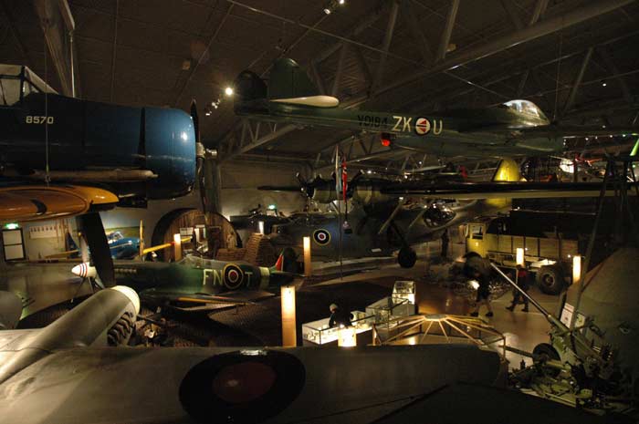
And it turns out to be a great museum and we are very glad we went. It does not look so large from the outside, but it certainly feels large on the inside. There are two wings (no pun intended) to the museum - one civilian and the other military. Shortly after we get there, there is an English tour of the military wing and we join this tour. It is a fascinating place to visit. The range of planes that they have on display hanging from the roof and sitting on the ground is incredible. In addition they have a number of exhibits on the history of military aviation in Norway, the war period and the post-war period as a member of NATO and being on the front line in the Cold War.
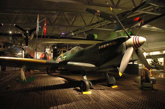
The planes on display include a Junkers 88 (recovered wreck), a U2 spy plane, Submarine Spitfire, F-104, F-86 Sabre, a huge Catalina, mosquito, Tiger Moth and lots of other planes (and one helicopter). The guide was very informative and told us lots about all the planes, their history and any role they played in Norway. We were soon running out of time as we made our way around the exhibits scattered all over the floor and high above us. After a while we felt it was time to move onto the civilian section. But it was just as well that we did the tour in the military section and spent the most time there. The civilian section was just not as interesting to us. It has extensive exhibits, but it did not just grab us like the military side.
After heading up to see the old control tower that was salvaged from the airport when they installed a new one (things certainly did seem simpler back then with the control panels with pieces of paper to control the much lower traffic volume in those days). Then it was time to head on. By the time we left the museum, the clouds had broken up some what and the sun was occasionally shining through. Perfect timing to be in the museum.
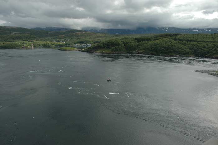
We will now be starting our journey along Route 17, which has been described as one of the most wonderful car trips in the world. We shall see as we shall put it to the test. We drive off at around 3:30 PM. We have the sun occasionally peaking through the clouds. We skirt the edges of the Saltfjord and make our way to the famous Saltstraumen - one of the, if not the, world's strongest tidal currents. The tidal current is caused by 400 million cubic meters of water flowing through the three km long and 150 meter wide strait between the Saltenfjord and the Skjerstadfjord. The tide reaches a speed of up to 20 knots. Vortices (or whirlpools) are formed, reaching up to 10 meters in diameter and 4-5 meters in depth.
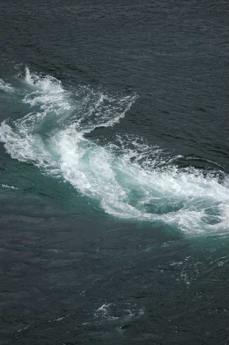
We park our car and then walk up on to the 700 meter bridge that spans the strait. From the top of the bridge we can look down onto the current rushing by. We are not there at the peak flow, but it is still an amazing sight. We can se the vortices form, causing large disturbances and then disappear as they move along with the current.
We certainly would not want to caught in that current in a light boat. Also - be careful not to fall in. We make our back down the bridge to the visitor center. After a quick look around, we head on our way, crossing over the bridge with our car. It is a very pleasant drive and on our way to Gildeskål we pass over numerous bridges and through three tunnels.
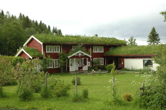
We take a brief detour up to Gildeskal to take a look at the old church built around 1130. We were not able to take a look inside as it was closed. But along the way we did see a really cool house built in the traditional style with the dirt roofs and timber construction. Around Storvika, we had planned to take the winding, serpentine road up to the Storvikskaret Gap. But the road has been closed following the construction of a tunnel that cuts through the mountain. Too bad, but it has started to rain, so we could not have enjoyed the views anyway.
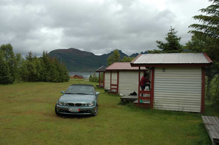
It is now around 6 PM and we decide to stop for the day. We have limited information on the campsites on this route, so we stop at the first one that we see. It turns out to be of the worst places that we have stayed on the trip and we would not recommend it. The cabins were poorly maintained and not well-equipped. The bathrooms and toilets we a bit grungy. Then, after we had settled into our cabin, the manager came by and told us not to drink the water. Something had contaminated their water supply and they had to flush out and clean the system before it was safe to drink. Good thing we had enough supplies of drinking water with us. It is an evening to hang out in the cabin - outside it is cloudy, misty and cold. We have our dinner and then relax reading and working on our journals.