Today we will explore the northern half of Lofoten, with the southern half tomorrow. And the weather has certainly changed for the better. The skies are clear other than a few white, wispy clouds. It is quite warm, boarding on hot if it were not for the cold wind that occasionally blows through. We have another relaxing morning, enjoying our little cabin. When we leave, we just close up and leave the key in the door.
We then carry on along the same dirt road along the northern edge of the coast. We make our way around another fjord that juts into the coast and then head south at Staumnes. This drive is quite a bit longer than if we had stuck to the main road - E10, but we are certainly enjoying the drive. We re-join E10 at Vestpollen and carry on south. We decide to just pass through Svolvær, as we had seen it on the way up on the Hurtigruten.
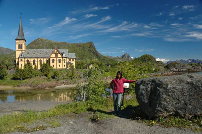
Shortly after we come to Kabelvåg, where we stop to see some of the sights. Kabelvåg used to be the largest fishing village in Lofoten, but it has been overtaken by Svolvær. The first sight we stop at is the Vågån Church north of the town. It was built in 1898 and is known as the Lofoten Cathedral. It is one of Norway's largest timber churches and can sit 1,200 people.
Outside the cathedral is the medieval "Troll Stone", which has a Norman cross carved into it. We also take a quick drive down to the Lofot Museum with a number of old buildings. But the weather is so great that we decide to head on and see the natural beauty of the place.
We carry on along E10, making our way through the Rørvik tunnel and turn off at Rørvik Beach onto route 816 to make our way along the 8 km road that goes along embankments and across numerous bridges to Henningsvær. Many of these bridges have only one lane and we have to take our turn to cross.
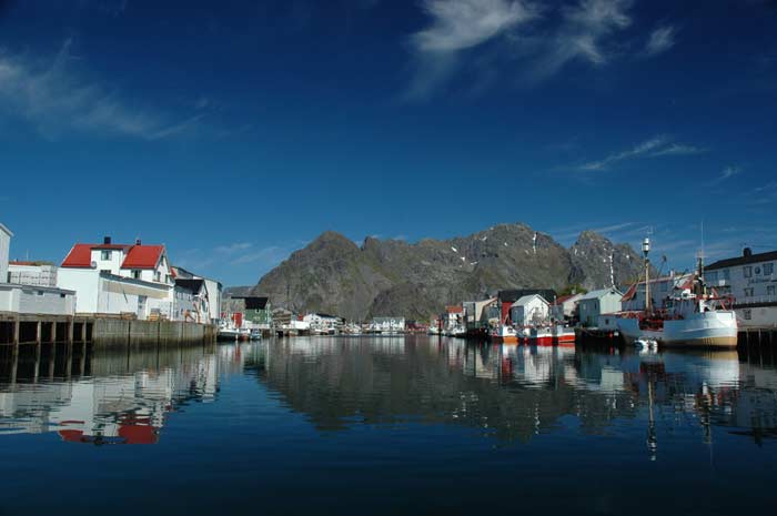
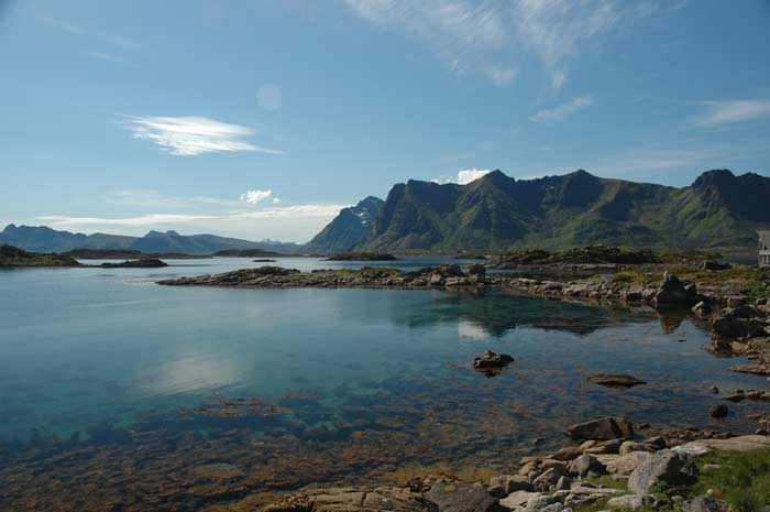
Henningsvær is a cool place, situated on a number of islands, making it a very typical fishing village. In some sense it feels like you are in the Venice of Norway as there seem to be channels of water on all sides. The road forms a fishhook pattern, and we call all the way around the hook to the dead-end. Along the way, we get off at the bridge at the base of the hook and take in the view of the fishing village with its piers, numerous boats and mountain background.
At the top of the hook, we get out and walk around the piers and check out a number of old buildings that have been turned into hotels and restaurants. Tourism seems to be a bigger business than fishing. But, of course, we cannot escape the smell of fish, especially as the islands are covered with the wooden racks that are used to air dry the fish.
On our way back along the main spine of the fish hook, we make another break to check out some shops and the view. We are very impressed at how well the buildings are preserved and restored. Then it is back along route 816, yielding a number of times to oncoming cars, to the E10. We decide to stop for lunch at Rørvik beach.
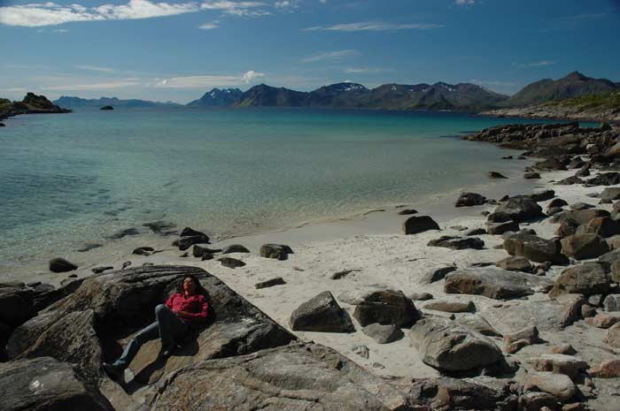
It is a wonderful place for a picnic. We bring our lunch down to the beach and sit on the rocks scattered amongst the bright, fine sand. We enjoy our sandwiches as we take in the bright blue of the sea and the sky with the grey and green of the land and mountains. A few white clouds slowly drift by, adding some dimension to the endless sky.
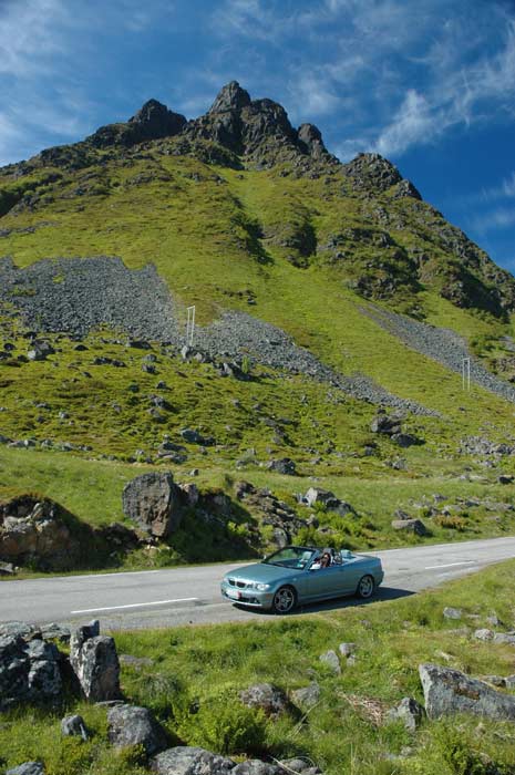
As we make our way along E10, we begin to cross the many bridges that link the islands that form Lofoten. We take the bridges across the Gimsøy and Sundklakk eddies to reach the island of Vestvågøy. Here we decide to once again leave the main road and take the scenic route along route 815 to Leknes.
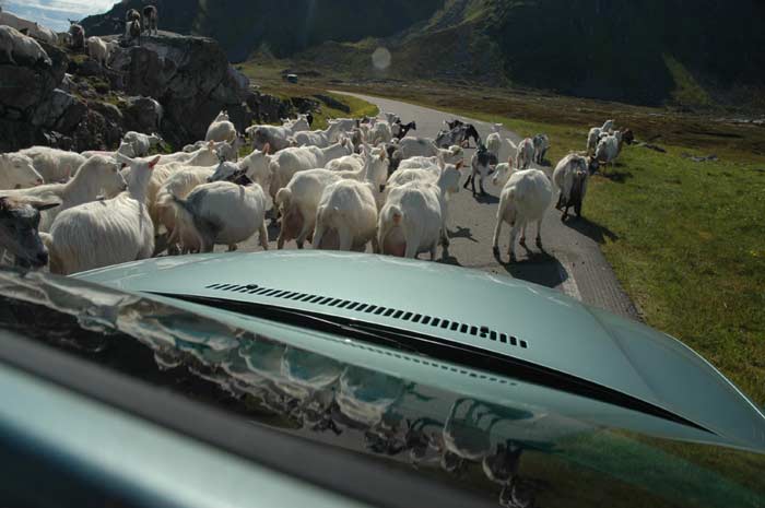
And it is well worth the detour. The road is narrow and winding, but also very dramatic with the sea on one side and the mountain rising up on the other. Along the way, we are delayed by a herd of sheep that seems to have taken over the road. They have no fear of the car and we have to slowly inch our way forward to get through them. The herd slowly parts as we move through, but then re-groups on the other side. A bus has arrived from the other side and had to wait as we passed through. He also had to slowly make his way through the herd.
Along the way we stopped for photos and also made brief stops in the small fishing villages of Stamsund, Steine and Leknes. At Leknes, we re-join E10 but rather than carry on towards the end of Lofoten, we turn back in the direction from which we came. We want to go and check out the Viking Museum at Borg. After only a short drive we are there.
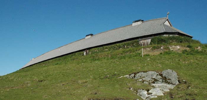
It is a very interesting museum. On the top of a hill, the foundations and remains of an old Viking long house have been found and they have built, right next to the original, a reconstructed Viking Chieftain's house was built. And they did an excellent job.
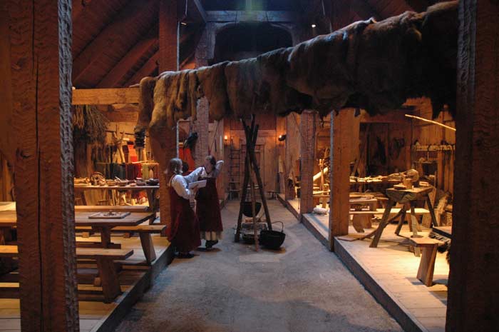
The interior has been broken into the various large rooms and exhibits on life in those days and in one of these houses has been re-created based on information available to-date. An English language tour was about to start, so we (the only ones) joined it. It made the whole experience much more meaningful. The first great room had exhibits on the household items, how food was made, sleeping arrangements, games, tools, etc.
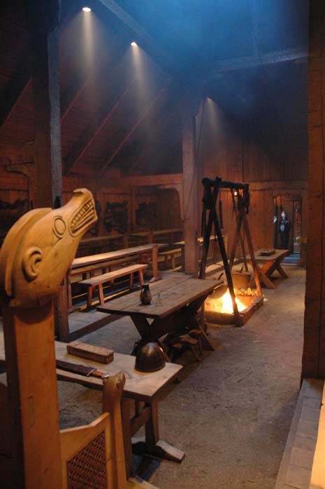
The second great room, separated from the first by the main entrance way was the large dining and meeting hall. The room is dominated by the large fire places and the chieftain's table. Along each side of the room are two tiers of tables with benches.
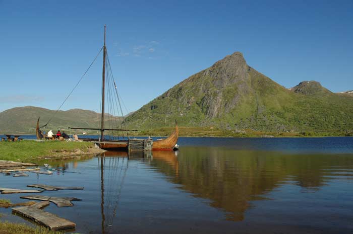
The third and final room, where the animals would have been kept, has been used to house a museum with various exhibits on Viking life and times. After checking out the chieftain's house, we take the 1,500 meter path down to the seashore where the museum has built and operates a replica of a Viking long boat. We go aboard and check out the famous Viking ship that was used to strike fear in some many people on the numerous raids around Europe.
We make the walk back up the hill to our car and head on our way. We have decided to make a short detour to the town of Eggum, another fishing village on the ocean side of the island. It is located on a grassy moraine ridge below vertical mountains and has an impressive rolling stone covered beach. The road is a dead-end, so we need to head back the way we came.
When we re-join E10, one turn back the way we came and head towards Leknes. Once again we pass through the town of Leknes and shortly afterwards turn off onto route 818 to make our way to Ballstad where we hope to find some accommodation for the evening. We arrive in Ballstad, another fishing village, at around 7:30 PM and we soon find a place to stay. It is not the cheapest - one of the more expensive places we will stay on our trip, but we just want to find a place to stay for the night.
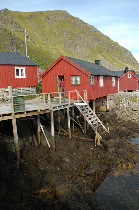
It is a hotel that has converted a number of the old fishing huts known as Rorbu into guest rooms. Our little rorbu is called Doktorbua. We quickly settle into our cabin, which has a kitchen, beds and attached bath. Based on travel schedule to-date, we have an earlier dinner. It is only 8 PM. After dinner, we take it easy napping and reading.

But then at 11:30 PM we decide to head out and see if we can see the midnight sun. Following the instructions that we were given, we drive up to Gravdal and then turn west on a small road which we take to Nappstraumen channel. But the weather has turned against us. In just a short time, a bank of clouds has rolled in and obscured our view of the sun. The clouds are blowing through on a strong wind, so we wait a while with no luck.
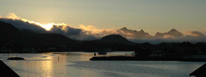
We decide to turn back and make our way to our rorbu. Along the way, however, we are blessed with a view of the midnight sun. The clouds have cleared in this part and we are able to see it over the channel that surrounds Ballstad. The excursion was not a waste. Back at the rorbu we get ready for bed, but not going to bed before we take one more look outside at the dim glow of the midnight sun.