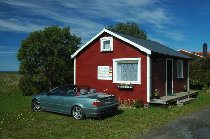
We wake up to a beautiful day - the weather has finally changed for the better. We have a leisurely morning and take advantage of our converted boat house. Breakfast is a slow affair at the table with the window overlooking the bay. We hang out on the deck and admire the view. Our host comes by and kindly offers us some photos and info on his boat houses for rent - his little hobby.
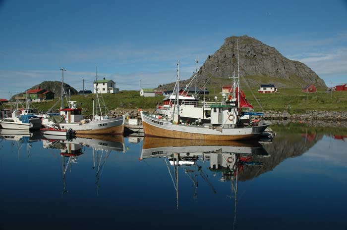
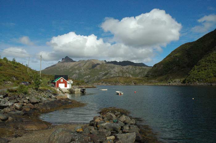
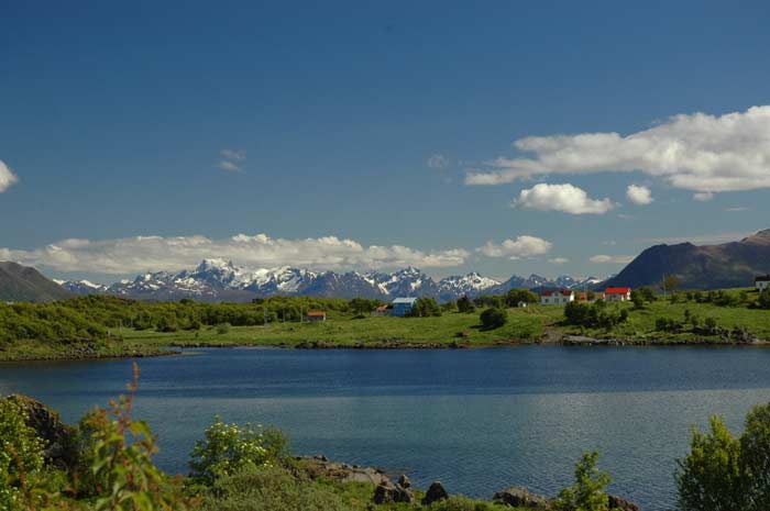
We are only ready to head off around noon. We take the next few hours to explore the seaward side of Bø. Our first destination is the picturesque fishing village of Nykvåg. In addition to the beautiful, protected boat harbor with it's colorful fishing boats, the small village is well known for it's bird rocks.
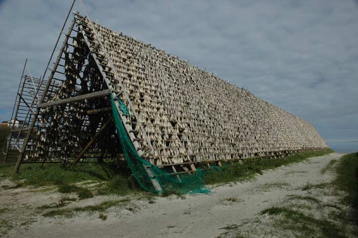
The steep rocks and cliffs around the village provide numerous nesting grounds that are safe from predators. There are a number of different areas, each with a different species of bird. It is a noisy home, with the birds squawking at the first sign of danger. We also go and check out the smelly fish drying racks - they are huge and are covered in fish hanging out to dry.
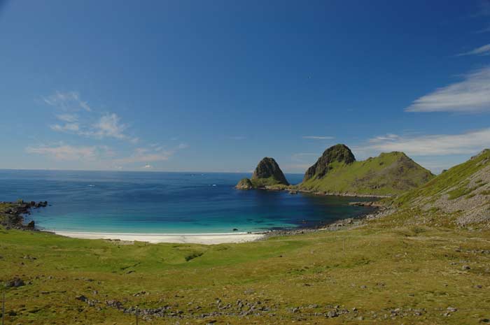
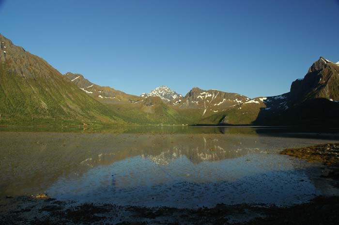
We follow the road around a cornice above the sea to Hovden, where the road dead ends. This is another small fishing village. We now have to turn back and return from where we started. We decide to see if we can drive all the way around the island and observe some it's many features. The features vary from quiet bays to sandy coves, pebble beaches to cliffs rising out of the sea, and flower covered fields to forests.
Soon the road turns to dirt and the way gets a bit rough and bumpy, but we carry on. We hope to be able to drive along a road marked on the map, but it turns out to not exist. It is possible that the road did at one time exist - the Germans built extensive tracks during their occupation, but some have been reclaimed by nature. We have to backtrack part of the way in order to reach 820 and make our back towards Sortland.
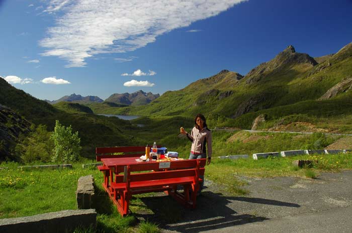
We pass up the valley to the entrance of the tunnel. We stop here at shortly before3 PM and have a wonderful lunch with a great view. The facilities are excellent. Then it is time to pass through the tunnel. When we reach the intersection with 821, we decide to turn north and go and explore the northern most point of Langøya.
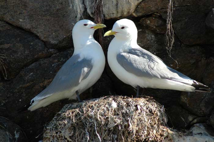
It is a very pleasant drive along the coast. We make a brief stop in Myre for some grocery shopping (tomorrow is Sunday, so we want to make sure we have all we need). We reach Stø at around 4:30 PM and take a quick look around this small fishing village. They also have lots of nesting birds in this village. At one point in time, we imagine that the only way to reach these villages was by boat - they must have been very isolated.
From Stø we take a brief detour to the church of Langenes which dates from the 1500s, but was rebuilt in the 1700s. On our way back down the peninsula, we take an alternative route via Alsvåg so that we can have a different view and drive. Soon we are back at route 820 and making our way to Sortland. Along the way we make a brief stop at the old Jennestad homestead, but we are too late for a visit to the old shop. In Sortland we top-up with petrol and then join E10 on our way to Lofoten.
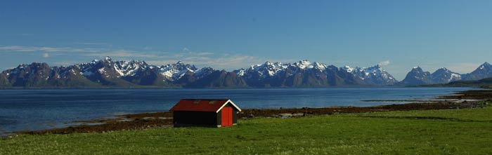
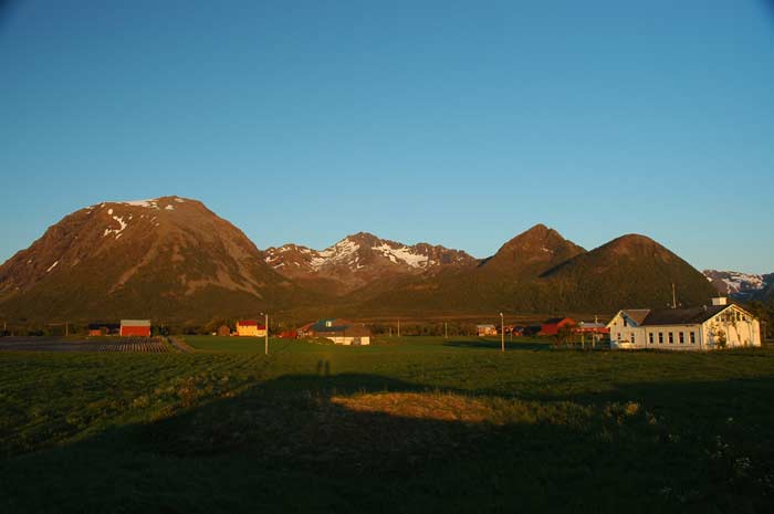
The few remaining clouds are clearing and it is turning into a wonderful afternoon and evening. We drive along the flat foreshore of Langøya with the views across the channel to the mountains lining Hinnøya. It is a great drive and we make frequent stops for photos and to enjoy the view.
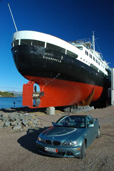
At the southern end of Langøya, we come upon the 1,020 meter long bridge to the island of Hadseløya. The bridge rises in a long arc and curves in a long bend as it comes back down in the outskirts of Stokmarknes. Stokmarknes is famous as the place where the Hurtigruten (coastal express) was founded in 1881 by Richard With. We arrive there a bit too late to visit the museum, but we take the opportunity to get a good look at one of the older styles of ships that used to serve this route. Back then, they were much more like freighters with space for some passengers. Now, the ships are really cruise ships that focus primarily on carrying people and not so much cargo.
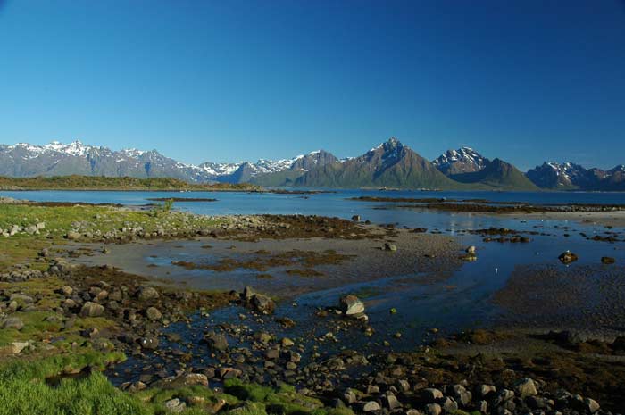
We carry on around the eastern edge of the island to Melbu, enjoying the view as we go. When we get to Melbu, we need to decide what to do. We can try to find some accommodation on this island, or take the ferry over to Lofoten and see what we can find over there. We decide to first see if we can find anything to the west of Melbu. While it is a great road to drive along, we do not find any accommodation. The road is a narrow one lane affair that snakes its way through numerous farms and their fields. We also have some amazing views of Lofoten and it's mountains. But soon we have to turn around if we are to catch the ferry and make it to Lofoten, where we will go and look for a place to stay.
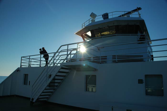
We have a 25 minute wait in Melbu before our ferry departs at 9 PM. The wonderful and practical thing about traveling in northern Norway in the summer is that it never gets dark, so even if we are late or need to carry on, it is not much of a problem. In fact, we often seemed to have some of the best weather in the evening. Our ferry takes us 30 minutes to cross the channel to Fiskebøl. It is a great trip - we wander around the decks taking in the views of Lofoten as we approach.
Once we arrive in Fiskebol, we have a choice of routes. We can carry on along the main route, E10, or take the in-direct route along the northern shores of Lofoten. We know there are campsites along both routes, but in the end we decide to go for the scenic route with one main reason - we hope to be able to see the midnight sun.
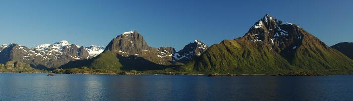
So we head off along the small road and it soon turns to a dirt track. But we carry on and we are rewarded with excellent views. The route takes some time as we have to make our way around a number of fjords that jut into the coastline, but it is worth it. A great drive.
Along the way, at the end of the Morfjord, we find a cabin for rent. It seems nice, but we pass on it as the shower and toilet are in the main building. In any case, after about 45minutes of driving, we come upon another cabin for rent at a farm that is on the sea. We take it - it turns out to be pretty god value. Well equipped with a number of rooms, kitchen, dining room and bath.
It is late, so we quickly get our stuff organised, have dinner and then a quick shower. But our evening does not finish there. It is now midnight, so we decide to go for a walk and see if we can see the midnight sun. And what a show it puts on. We walk across the fields to a mound and sit back and enjoy the sun as it slowly sets towards the horizon, but before it can make it, it slowly begins to rise. The start of a new day within seconds.
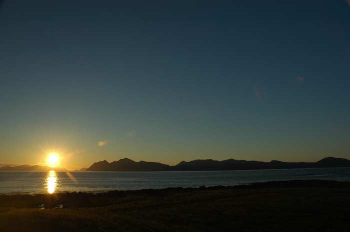
It is amazing how we can see the color of the light change as we go from a setting sun to a rising sun. It is just before 1 AM and we can see the dawn washing away the dusk. After about an hour, we decide to head back to our cabin and call it a day.