Today is the tough day on the Inca Trail - we have to high passes to climb to reach our camp site for the night. We are woken up at 6 AM by a shake of the tent and some hot coffee and tea. The guide and some of the porters come to our tent with a selection of coffee, tea and coca leaves. There is also a bowl of warm water to wash with. What a way to start the day!!!
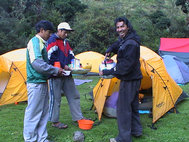
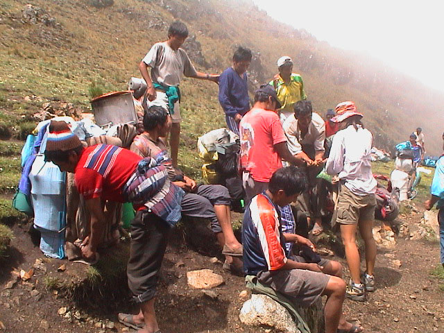
After a quick breakfast, we are introduced to the porters. We take this opportunity to each give the porters a bag of coca leaves which they will chew as they carry all the heavy loads (which includes our stuff, the tents, the food for three days, the gas tanks, the cook and dining tents, the stools and the tables). We also wish Steve a happy birthday - what a way to celebrate your birthday.
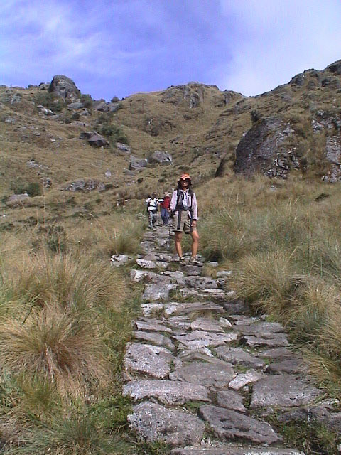
We head off at 7:15 AM and our objective for the morning is Dead Woman's Pass - the highest point on the Inca Trail at 4,239 meters. They say it can take any where from 2 to 6 hours. A bunch of the guys zip off and head on up the steep trail. Lars decides to see what he can do (it has been a long time since he has tested himself hiking) and leaves Jacqui to go on alone (she does not mind - less pressure that way).
It is a steep climb and quite tough in the thin air at this altitude, but Lars is surprised to reach it after only one hour and 35 minutes. Craig and Richard beat me up there. Jacqui took under one hour - she just kept up a steady pace the whole way. She was the fifth person to reach the pass.
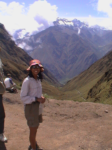
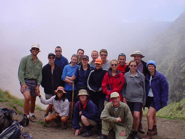
It was a great day - clear skies and we spent about two and a half hours at the top enjoying the view while we waited for the rest to reach the top. Jacqui gave out coca leaves to some of the porters resting at the top and they seemed very grateful.
We have a forty-five minute descent down into the valley to the lunch spot. It is a large camp complex and so is a bit crowded and not too nice, but we enjoy a huge meal and a short siesta. Then it is a "short" climb up to the next pass (yeah, right). We had prepared ourselves for the morning climb, but this one had not been played up so much and on our full stomachs, it seemed tougher than the morning climb up to Dead Woman's Pass.
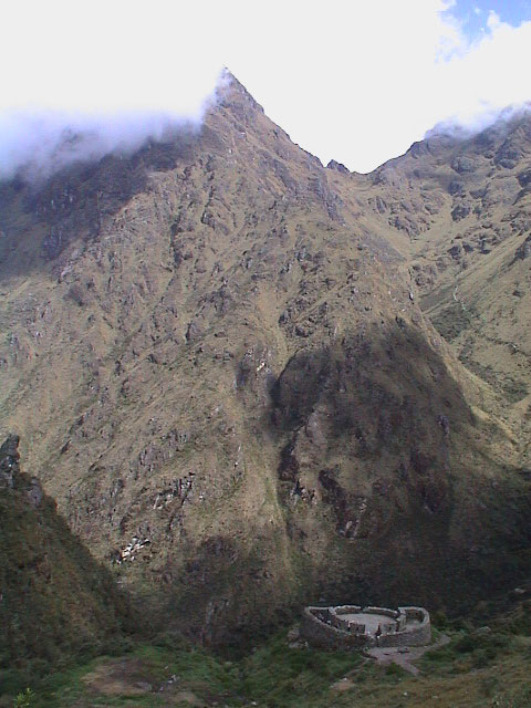
On the way up to the pass, we have a short stop at some Inca ruins along the way. It is amazing how many of these sites the Inca's built all over the Andes. This is also where the original Inca Trail begins - the stones and trail that we will be walking on are the original ones put in by the Incas over 500 years ago.
After a tough climb, we reach the pass and then head straight down - the clouds have begun to blow in so there was no view. This is also where the cloud forest begins and the whole environment starts to change as we walk down. We reach the Sayaq Marka ruins at 3:30 PM and these are very impressive. The workmanship and details that have been carved into the rocks is amazing. There are water channels, fountains, terraces, door hooks, windows and a fantastic view (which, however, has been obscured by the clouds).
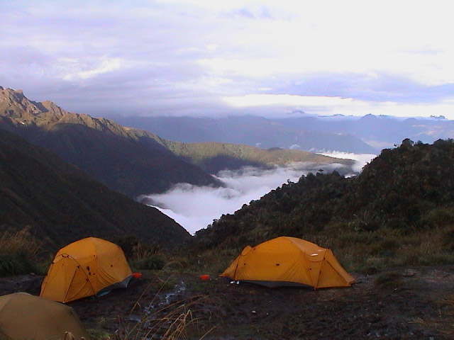
After the tour of the ruins, we head off to the camp site which is only a short walk away. Just as we reach the camp site it begins to rain, so we throw our stuff into the tent and get organised. It is a nice camp site (with a great view that we enjoy in the morning), except that it is a bit muddy with all the rain that they have been having. We have to be careful as we walk around the campsite to make sure that we do not bury our feet in the mud.
We go to the dining tent for tea (which includes popcorn) and dinner is served soon thereafter. Once again we finish full and satisfied (we will not lose weight on this hike). It has been raining on and off and we use a lull in the rain to dash to our tent. The problem is that a mist has fully enveloped the campsite and we are not sure where our tent is. We have only one flash light to share (good thing that we at least brought that one), and we have to navigate through the mud while trying to find our tent. We make it in the end and we did not even pick up too much mud.
We get ready for bed and lay back in our bed and (as we were the first to leave) listen to the other people curse their way to their tents through the mist and the fog.