Today we will be heading down to Koppang - a drive we also did back in June. But this time we will have more time, so we plan on seeing a few of the sights along the way and making some detours to do so. Packing up this morning takes a bit longer as we need to put away all the laundry that we washed yesterday. Some was still hanging in our cabin drying out. The morning had started out very heavily fogged in, but as we are getting ready to leave, the fog lifts.
We leave shortly after 11 AM and head on south on route 30. We soon come to Tolga were we take our first detour. After taking a look at the Tolga church, we drive west on a small country road to the small village of Vingelen, which pretty much consists of a handful of old farms and farmyards. It is a beautiful little spot and the best way to see it would be to spend a night in one of the old farms and do some walks in the countryside. We do not have the opportunity available to us this time, so we take a quick drive around, stopping at the old church and information office.
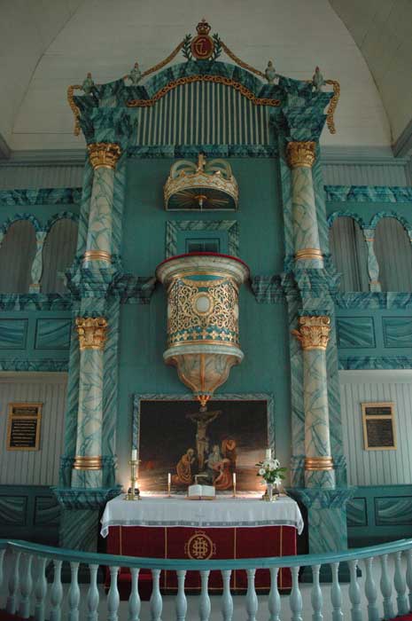
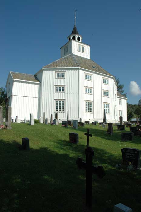
We make our way back to the main road via a different country road and once again re-join route 30 heading south. At Tynset, we stop to check out the 1795 octagonal church where the pulpit is placed above the alter. The gallery is also beautifully decorated. Here, we deviate from route 30, which we had driven on during our last drive here, and make our way to Highway 3 and Alvdal.
Alvdal is famous, for Norwegians at least, as the home of Kjell Aukrust, the creator of funny tales and drawings. Outside the church there is a statue which commemorates him and two of his most popular characters. Our stop here is brief and we carry on south until we reach the small road that will take us back to route 30. And this small, country road takes us to our next sight - Jutulhogget.

We turn off onto the gravel road and head the short way up to the rest stop where we stop for lunch. It is a great spot in amongst the trees with picnic benches and a latrine. The shade of the trees is very welcome on a hot day like today. After we have finished our lunch, we walk the short distance to the Jutulhogget.
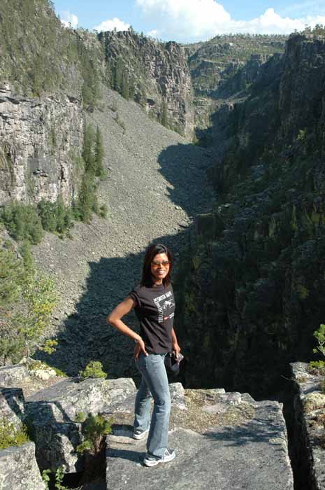
Jutulhogget is a strange geological formation created about 10,000 years ago at the end of the last ice age. The Jutulhogget is a 100-200 meter deep and 2.5 km long canyon that cuts through the ridge separating the Glomdal and Tydal valleys. The deep gash in the ridge was created when a huge ice-blocked lake broke through it's dam and the massive force of the water, rocks and ice cut through the ridge. The forces must have been tremendous.
Legend has come up with a more imaginative origin for the large gash. The legend tells us that the cleft was created when to huge trolls fought over the ridge when one wanted to divert the water from the other's valley into his valley. The second troll did not take kindly to this and they fought and the first troll was defeated and buried in the huge Jutul rock moraine. Massive amounts of water or two fighting trolls - now which is more interesting and exciting.
From here we carried on along the small gravel road that would it's way up and along the ridge through the forest. We came down the other side of the ridge and re-join route 30 carrying on south. From here it is a short drive to Øvre Rendal, where we turn off west on to a dirt toll road to drive to the lake of Sølensjø and Norway's only inland fishing village - Fiskevollen.
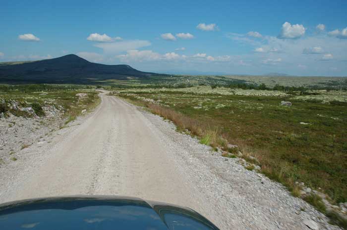
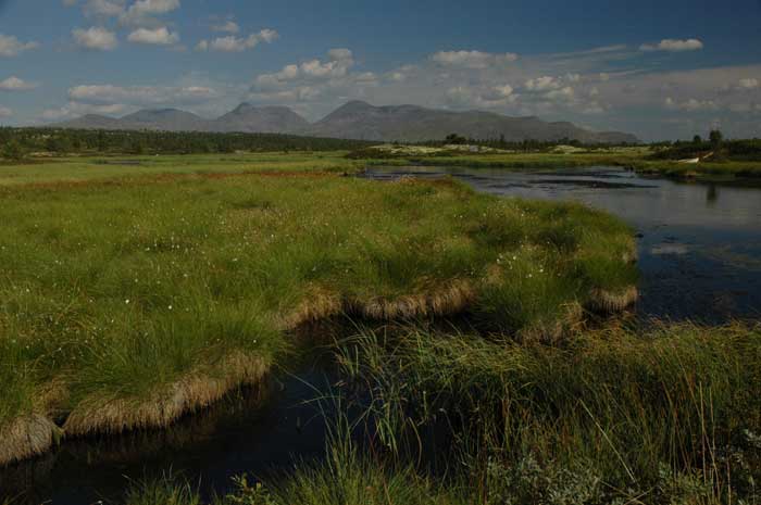
The drive is quite far along the flat, bare plateau to the lake and the village. Along the way we come to scattered small setra, or summer farms. These places are very isolated. There is no electricity and no phones. It must be so peaceful and relaxing to come out and stay here for a rest. The drive is pretty monotonous, broken up every once in a while by a few streams or ponds and mountains in the distance.
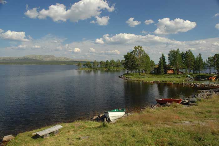
We arrive at the fishing village shortly before 4 PM and we are a bit disappointed. While it is a beautiful spot, we really did not see much of the old fishing life that must have existed here at one point. The lake is a stunning dark blue, set against the low mountains on the horizon with scattered trees. The old fishing huts are clustered around one peninsula and most have been converted to summer cabins. It has lost some of its charm and as we are not staying over night in one of the cabins and have no great interest in fishing, it was a bit of a let down after the long drive.
After a short walk around, we head back to our car for the long drive back to route 30. Once back on route 30 we head south and drive to Koppang, our destination for the next few days. As in June, we are going to have another family gathering here. Most of the people will be arriving tomorrow - today we are joined only by Live (Lars' cousin).
We get there in the late afternoon and have a relaxing evening. We hang out, have some dinner, do some reading and go for a stroll around the fields in the neighborhood. That night we go and sleep in Sten's place which is just a short walk up from the farm (another of Lars' cousins).