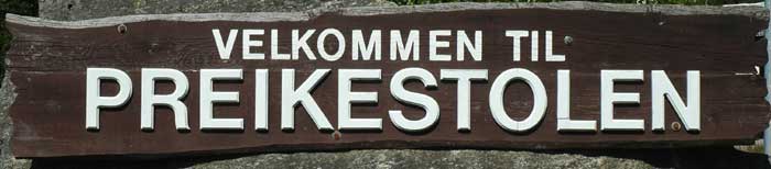
We are up very early this morning - at least for us - at 6 AM. The campsite is very quiet - only a few other people are stirring. We get ready and have a light breakfast. We are heading off to hike to the Preikestolen (or Pulpit Rock). We have decided to leave our tent at the campsite so that we can come back and shower. We have woken up to a glorious day - the sky is clear and blue, except for a few small puffy clouds.
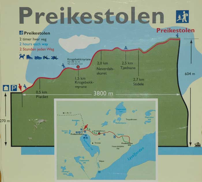
It is time to head off. We jump in the car and drive up to the trailhead. There are only a couple of other cars and a few motorcycles in the car park. What a time to start our walk. The air is still cool and there is no one around. We put on our packs and begin the walk out to the rock. It the few kilometers that we walk it is amazing how diverse the scenery and surroundings are.

We begin with a steep walk up through a forest. After a while it levels out and the trees have thinned out. The ground becomes very swampy in spots. In fact, it is so wet that they have installed wooden walkways elevated above the ground - good for the hikers and it protects the sensitive flora.
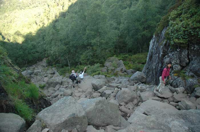
Then we reach a gully and have a steep climb up the gully to the plateau above - we worked up a sweat on this section (we are just glad that we are still shaded from the rising sun). After going about two-thirds of the way, we come upon a number of small lakes that make great swimming holes. For us, we decide to head on. It has, however, started to get very warm. We are now exposed to the rising sun and we have no shade from any trees.
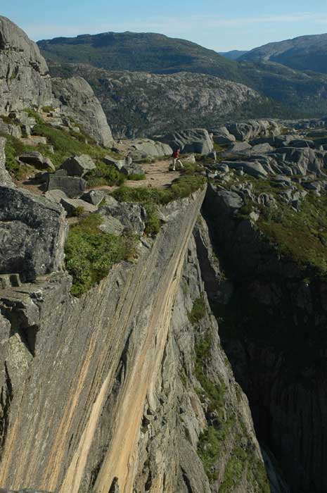
From here, the path heads onto a smooth rock surface that slowly heads up. And then we come to the edge of a cliff that wraps around to the right. The trail follows natural ledges carved into the cliff face, with the occasional wooden walkway to cross the few gaps in the narrow ledge.
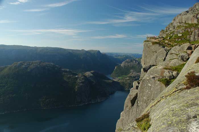
It is at this point that we are rewarded with the stunning view of Lysefjord and the surrounding mountains. The fjord is magnificent - it looks like a huge ax has cut a massive slash through the earth with the steep vertical sides formed by the cliffs on each side.
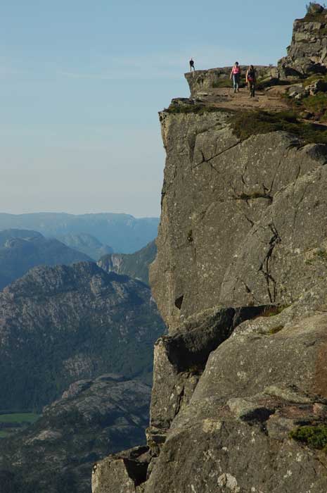
The ledge that we have been walking on has turned the corner and we are now on the edge of the fjord looking down the length of it. We hang out here for a while enjoying the view. And then we carry on along the ledge - it is actually quite wide, maybe 5-10 meters, but feels very narrow when one side of the ledge falls straight down over 600 meters in a sheer drop to the sea below.
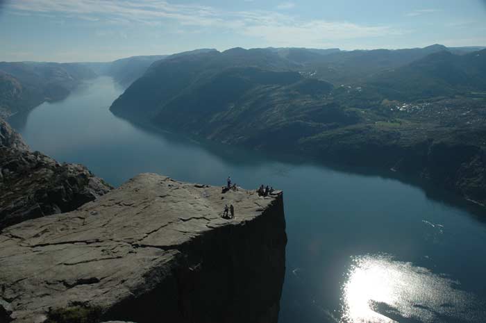
We make our way along the ledge, not quite sure how much further we have to go. Given our perspective (i.e., the same level as the rock), it is hard to see where the Pulpit Rock is. And then we are, all of a sudden, on it. And we are pleased to see that there are only a couple of other people there. During our whole walk we encountered virtually no one and we almost have the rock to ourselves.
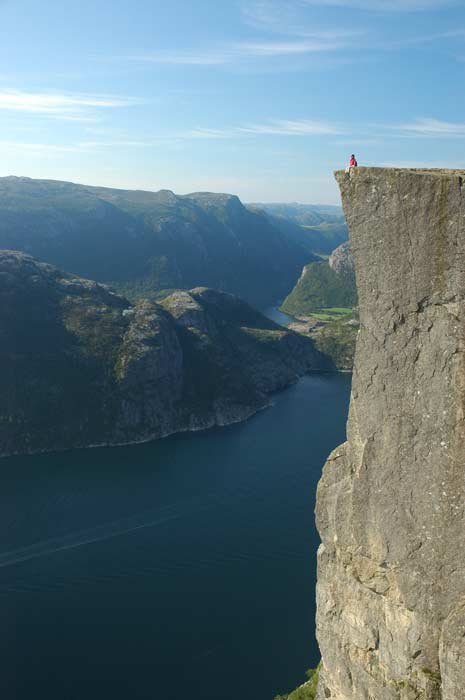
Of course, we have to take some pictures. Lars finds a nice ledge from which to take pictures of the pulpit from the side. Jacqui goes and poses on the edge. She, of course, has to go and tempt fate and she sits on the edge of the 600 meter cliff with her legs dangling in the air. Lars' heart only stops pounding when she slides back and pulls her feet back up onto the ledge.
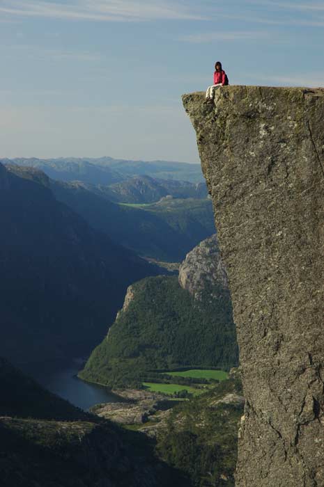
We spend some time hanging out on the rock. We have a snack and drink some water. We then hang our heads over the edge and look down the 600 meters to the rocks and water below. What is amazing is the pull of the abyss. And that is the only way to describe it - you feel like you are being pulled over the edge. There is some force that just seems to be slowly drawing over and down. It is a very strange feeling. The mountains, cliff, water and distances have this effect.
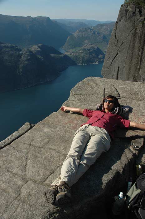
But we do not jump and continue to enjoy the fantastic panorama over the Lysefjord and the surrounding mountains. What a glorious place. We hang out some more and take lots of pictures. Then it is time to go. We decide to take the new path back up and over the plateau behind the rock. This affords us some different views and a beautiful perspective over the rock and the fjord. Lars drops down to a small ledge and tries to get some additional pictures from there. The climb back up is not too easy, but with Jacqui's help, we are back on the trail.
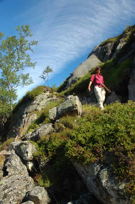
The trail takes us over the plateau and we make our way down the other side. We have a great view of Stavanger and the islands all around and the sea behind.
Once on the other side of the plateau, we re-join the main trail. At this point we meet the huge crowds that are now making their way to the rock. There are hundreds of people on the trail. The rock is going to be packed - we are not sure how they will all fit on the rock. We are so glad that we went earlier - not only was it not so crowded it was cooler. We pass by the swimming holes and over the swampy bit (almost getting pushed off the wooden pathway by the crowds) and into the forest. From here we make our way back down to the car park.
After buying a few souvenirs, we drive back to the campsite. Once there, we have enough time to organise our stuff, pack up our tent and have a shower (very much needed) before checking out of the campsite and heading on our way. We have now turned north and are heading up along route 13 with our next major objective being Trollheimen much further north, but there is plenty to see and do along the way.
After about an hour we arrive at Hjelmeland, where we have a 20 minute wait to catch the ferry across the fjord to Nesvik. Shortly after disembarking from the ferry, we find a place to have a quick picnic lunch. We then carry on along past Sand and into the fertile valley of Suldal. This is an interesting place to drive.
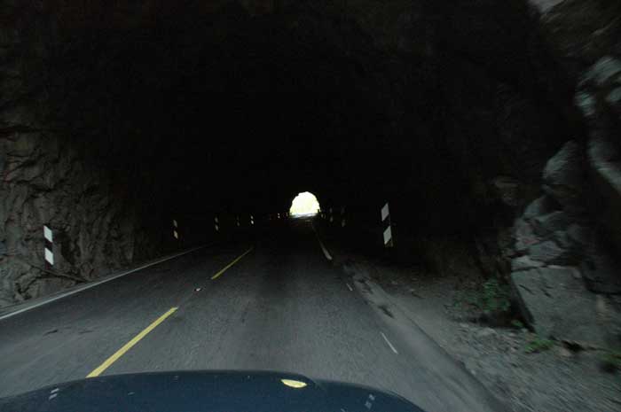
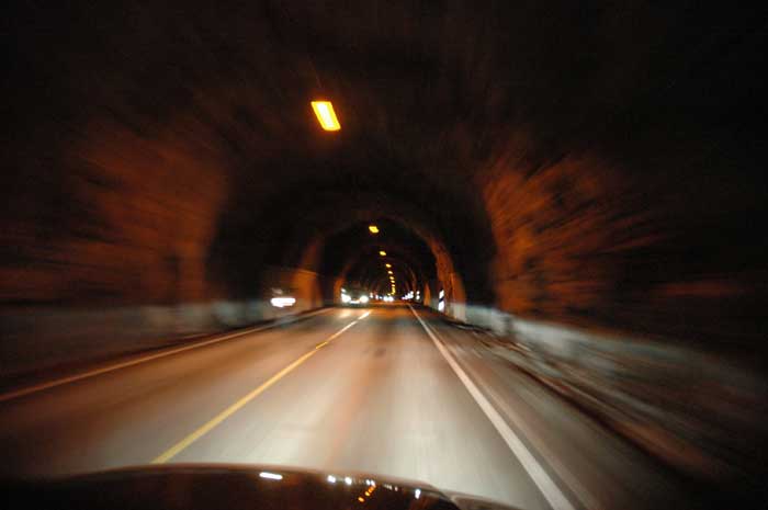
We pass along side the Suldal lake, where a sea serpent put the fear of God into them in the 19th century. It was only in 1892 that two brave local men went to check it out - it turned out just to be a giant collection of rotten branches, leaves and slime. Also, as we pass along this 22 km long stretch, 9.3 km of the road runs through seventeen tunnels. Some are lit, and some are not.
We carry on north to another one of those amazing roads in Norway. At Horda, we stick to route 13 which briefly joins with E134. Here we begin our ascent of the Røldalsfjell. While we are on the "E" road it is a modern, well built road. Wide lanes and gentle bends. The most amazing part of this stretch of the road, however, is the corkscrew tunnel. Yes, a corkscrew. We are taking this switchback turns up the mountain side when all of a sudden we enter a tunnel, which carries on upwards but we are going in a big circle in a corkscrew fashion. It is great. We re-emerge and carry on up the switchback turns. Then, just before we enter a modern tunnel going under the mountain, we spot the turn off to the old road. That is the way we want to take.
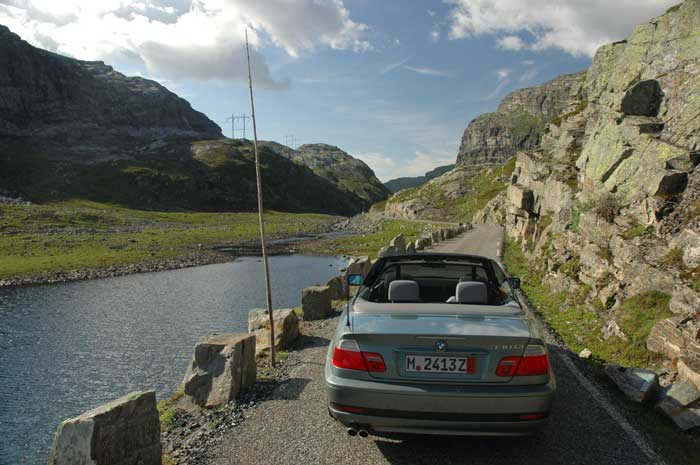
This old road, called Hordabrekkene was built from 1874-96 and winds up the mountain side in 16 bends with a maximum gradient of 1:10. It is a fun and wild road with great views. There are not many barriers, so taking the many turns is exciting. A few other cars also also using the old route, so we need to be careful. There is often only space for one car.
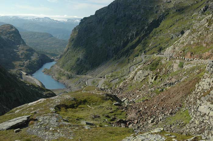
As we approach the top of the pass, we enter a wild and desolate canyon-like gorge. We have some magnificent views. After passing through the gorge, we come to the other side where we we need to descend down more hairpin turns to re-join the modern highway below. What a great drive.
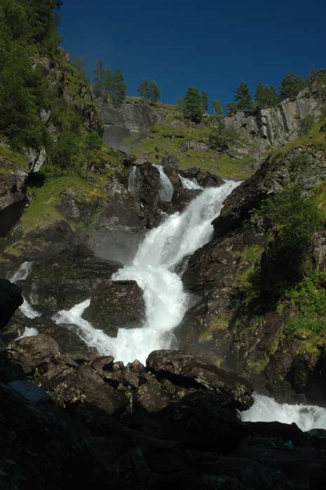
Once back on the main road we carry on until we arrive at Låtefoss. This water fall cascades down the side of the mountain like a white avalanche - it is abroad sheet of water. During high water, the spray from the falls will wash the cars that drive by below. Lots of people get out and take a closer look at the falls. It is very picturesque with the old arch bridge in the foreground.
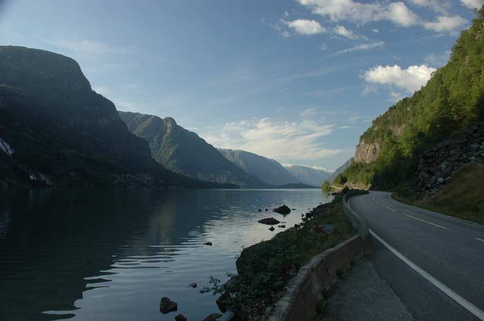
As we drive north from here towards Odda we pass numerous waterfalls that drape the cliff faces that drop into the valley we are driving up. One after another they line the walls of the valley. Once we are in Odda, we make a brief stop to fill up on petrol and to top up our engine oil. Then we decide to drive up the western side of the Sørfjord. This fertile mountain side is known for the large orchards - mainly cherry trees. We head all the up and pass Utne, now turning west with the fjord. We begin our search for a place to stay for the night.
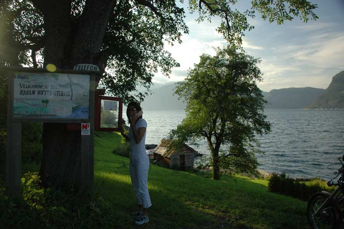
After checking out (sometimes via a phone call) a few cabins and campsites (which are all full), we find a campsite located right on the fjord with a place to set up our tent. All the cabins are full, but they have a communal kitchen where we can prepare our dinner. While Jacqui is getting dinner ready, Lars is setting up camp underneath a cherry tree.
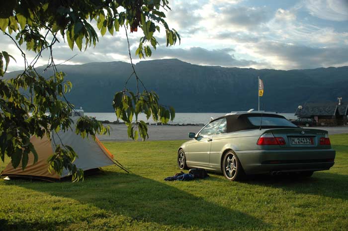
We enjoy dinner and some wine outside at a table on the edge of the fjord and watch as the sun slowly makes it's way down to the mountains on the other side of the thin fjord. It is a great spot. For dessert we have a couple of boxes of fresh cherries that we bought at a nearby stand. They are so juicy and sweet. Some of the best that we have ever had. We are stuffed by the time we finish them off - we just cannot stop.