Once again the weather was not that good so we covered a fair amount of ground. After a bit of a snooze and a late breakfast, we left our cabin at around 11 AM and headed on our way. In our guide book, we had read about a very cool rock formation that was described as "1,381 m high and is said to be the most remarkable natural obelisk in the whole world." Well, we had to try to see this. We were advised to take a detour on route 827 and, after passing through five tunnels of which the last is the 2,900 meter Stetinden Tunnel, to turn around and look back up.
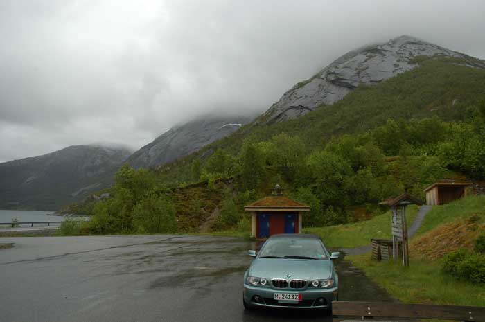
Well, we got through the tunnel, stopped at the rest stop and looked up. All we could see were clouds. But as the winds were strong and the clouds were swirling here and there, we decided to wait around for a while. The rest stop was well equipped and so we took advantage of a shelter to make our lunch out of the occasional light rain.
Also, while we were hanging out there, it began to hail. The hailstones were medium sized and we took cover in order to not be hit. But it stopped almost as quickly as it began. Finally after hanging around for a while, the peak briefly makes an appearance between the clouds. It really is a remarkable mountain.
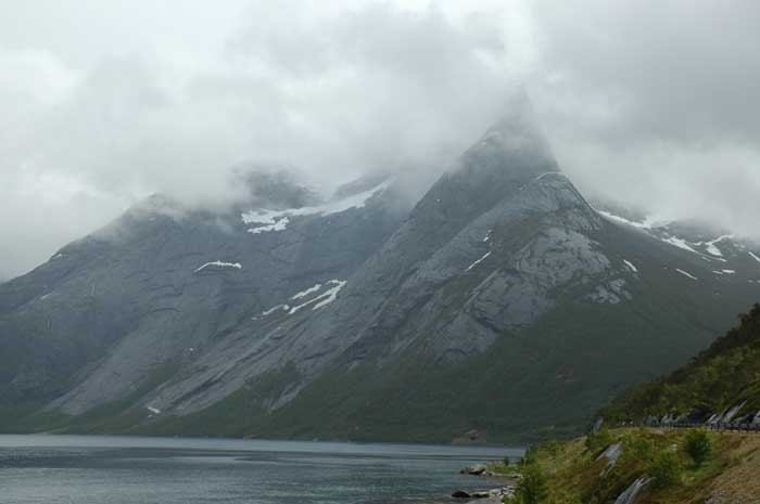
After our brief glimpse, we decide to head on along the edge of the fjord. After we have driven a short way and before we turn the corner, we look back and notice that the clouds have seemed to clear even more. We decide to hang around and see if we can get a better view of the mountain. And our patience is rewarded - the mountain juts up in a perfect obelisk shape. We can see why it is a real challenge to climb (and no bolts allowed).
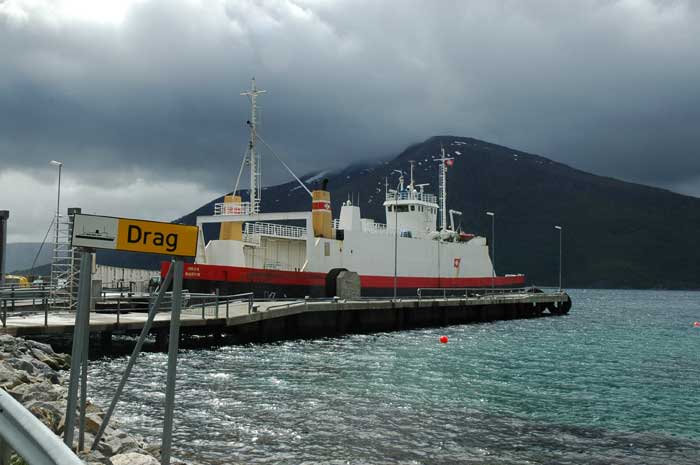
We carry on and shortly arrive at Kjøpsvik, where we need to catch the ferry across the fjord. We have timed it well and we make it onto the ferry MF Varvik after 15 minutes. The ferry Drag takes about 45 minutes to cross the fjord to the town of Drag. From Drag we drive the short way to the E6 and turn north, but we soon turn off to go on a short detour along route 81 to Hamarøy. Along the drive there are further strange peaks to be found.
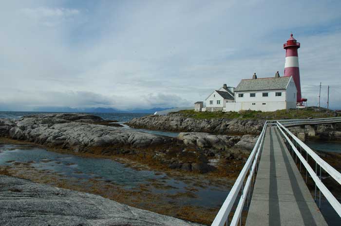
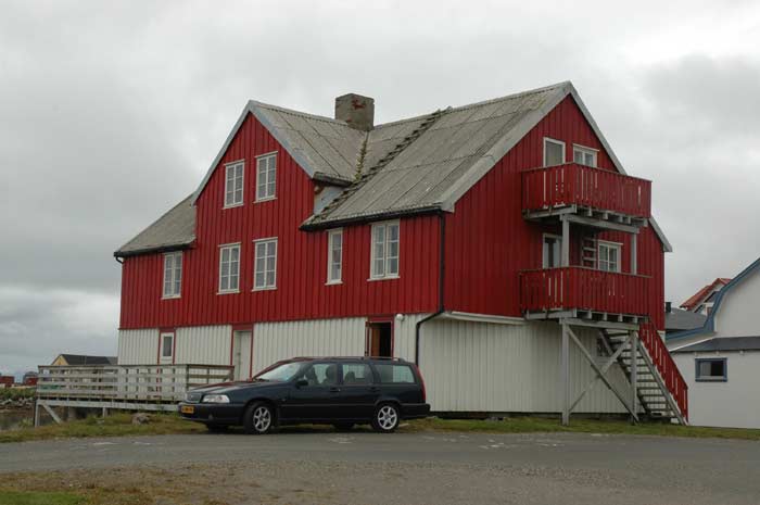
We go all the way out to the small village of Tranøy, where we first take a look at the lighthouse located all the out on a lonely spit of land with the islands of Lofoten in the background. We walk part way out to the lighthouse on the elevated walkway. It certainly is an isolated place.
We then have a brief visit to the town itself and check out the view to the 691 meter high Tilthorn, a peak with room for only one climber at the top. We then turn back, and as we are at the end of the road, we need to backtrack to get back to route 81 and E6.
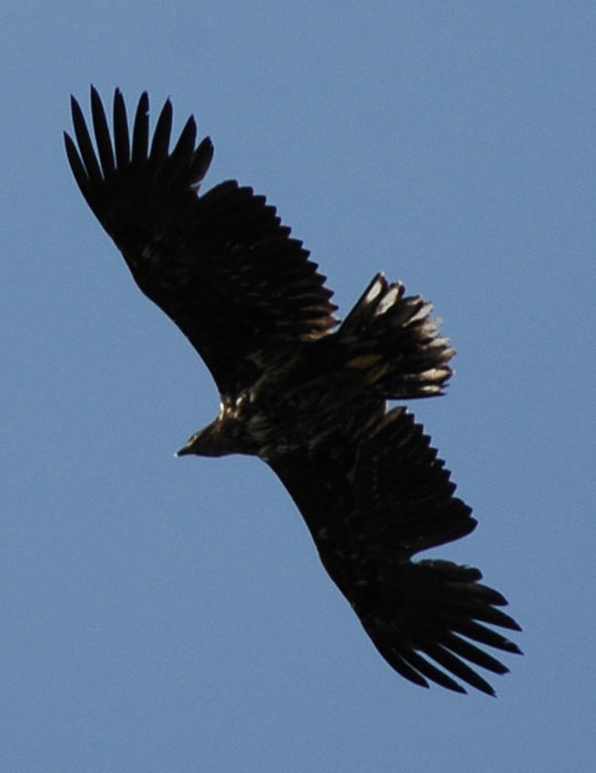
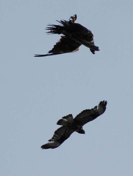
Along the way, the weather has improved and we have our top down. While driving along, we noticed a couple of sea eagles soaring way above us. We quickly find a place to stop the car on the narrow road and we watch then for about 15 minutes as they swoop through the sky. They are so graceful and are a wonderful sight to behold. At times they seem to be playing (or maybe fighting) as the smaller one would dive towards the bigger one, who would take evasive action.
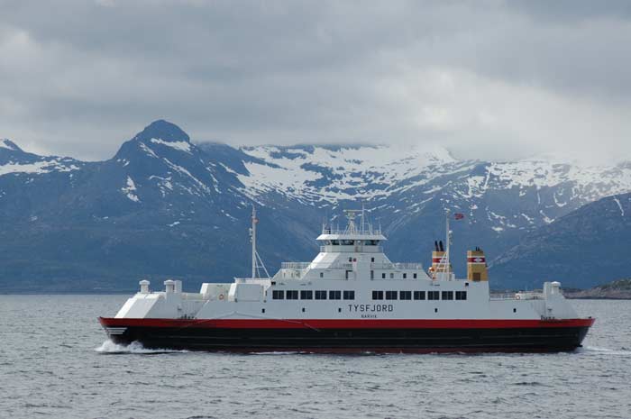
It is soon time to head on as we have to get to Bognes to catch a ferry. We get there in plenty of time - 20 minutes until departure. The ferry ride to Lødingen on the ferry MF Lødingen takes us a bit over an hour. It is a pleasant ferry ride.
We arrive at Lødingen on the island of Hinnøya just after 6 PM. We are well on our way to get to the Vesterålen islands, our next goal. The weather has turned nasty again - cloudy with occasional rain, so we decide to skip Harstad and just drive all the way to the northern tip of Vesterålen. We pretty much drive straight up there with no stops as the weather does not allow us any views.
We skirt by Sortland and make our way up to and through Risøyhamn. We pass over the bridge onto the island of Andøy and drive up the eastern coast of the marshy island, interspersed with rocky hills that jut up from the green surface. We arrive in Andenes at 8:30 PM and look for some accommodation. As usual, we arrive too late to get some information from the tourist office. This is a pretty big town by Norwegian standards, but we do have some information which tells us that there is a youth hostel in the center of town. We quickly find it and they have a double room available so we take it.
It is simple, but clean. They have a kitchen available where we can cook our dinner. After dinner, we decide to have our showers. The bathroom is large and has hot water, it is just that there is no heating. And it is now really cold. So, the shower itself is nice, but standing in the cold air dripping wet is not so pleasant. It is then time to head off to bed.