We have a bit of a lay-in this morning and are only ready to head off around 11 AM. The weather has not excited us very much this morning - cloudy and occasional rain. But we still must, of course, go and visit the Alta Museum. They have an amazing display of rock carvings at the Hjemmeluft area near Alta, just off the E6. The rock carvings range in age from 2,500 to 6,000 years old and it must be one of the largest collections anywhere - over 4,000 have been recognised (not an easy task as we shall see) in four separate areas. We will see all the areas.
We buy our tickets and head down to Stop 3 on the wooden walkways that take you through the area, avoiding damage to the natural vegetation. We pull out the guidebook and start to examine the scenes depicted at this panel - Bergbukten I. Bust soon there arrives a huge French group with over 50 people. They crowd around us and even push us away from the spot that we were using to examine the carvings. Soon the guide begins her talk and it is impossible for us to focus - we cannot even discuss the carvings amongst ourselves. The tour guide even has the gall to tell us that we should wait as they are in a rush. But they certainly take their time. In the end, we give up. We decide to head back to the museum building itself and to take a look at the exhibits there.
Well, things worked out for us in the end - just as we got into the museum building it started to rain. Good thing we are now indoors. We take some time to wander through the two floors of exhibits, some on the rock carvings and others on local life through the ages. It has then stopped raining, so it is time to get back out to the carvings.
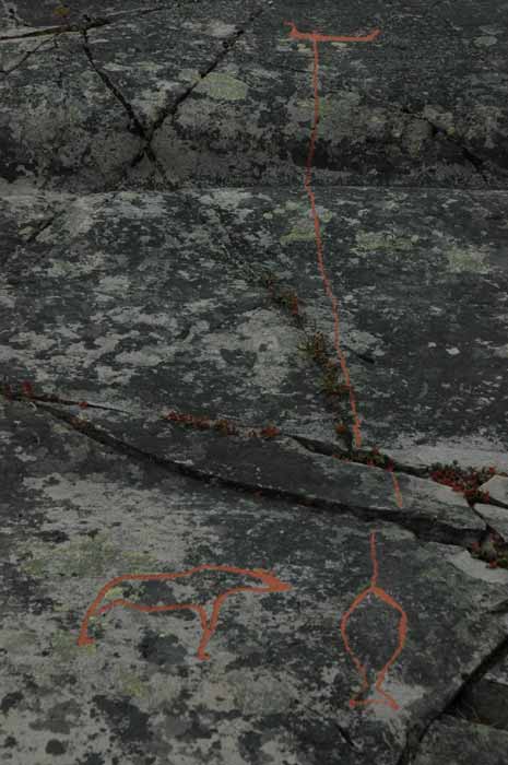
Back to Stop 3. These carvings belong to Phase I, are located 23.0 to 25.5 meters above present sea level and were made about 6,200 to 5,300 years ago. The carvings at this stop are spread across a long stretch of rock and the include so many different scenes. It takes us some time to work our way across using the guide book to help us along.
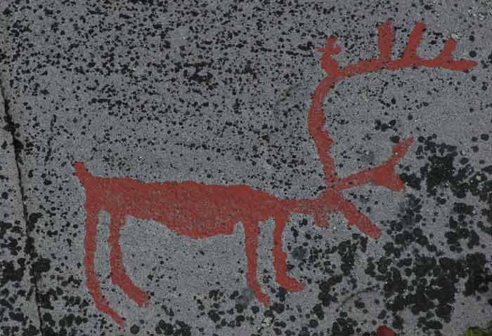
We have all kinds of animals, humans, boats, tracks and hunting scenes. The reindeer fence is the oldest picture known in the world where fences are used for hunting or to confine reindeer.
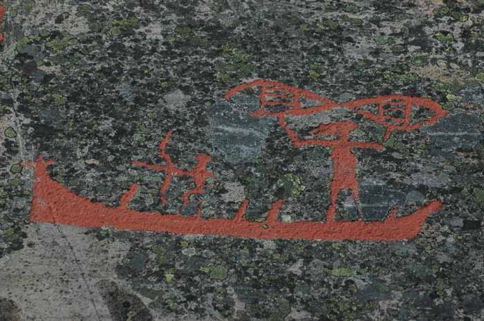
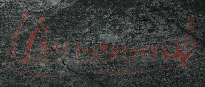
Then onto Stop 4, which is also part of Phase I and is called Bergbukten IVB. Lots of different figures. We have a female bear with two cubs in the middle of a reindeer herd that are being hunted. We also have boats with humans fishing for halibut (on the hooks). This scene also includes the image of the boat that has been chosen as the logo for the museum.
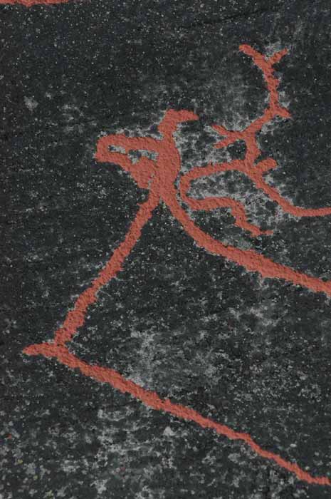
The panel at Stop 5, Bergbukten II, belongs to Phase II and the carvings are between 5,300 and 5,200 years old. This is a small panel and the carvings seem more basic. There are some interesting reindeer and a person holding a bird by the neck.
The figures at Stop 6, Bergbukten IIIA, also belong to Phase II. Most of these images are of boats chiseled in outline, with an elk figurehead on their stem.
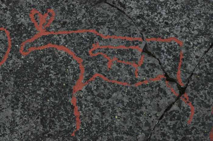
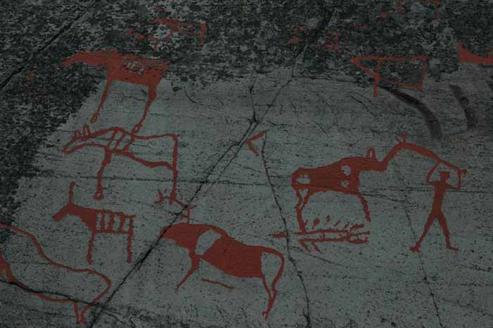
At Stop 7, Ole Pedersen XI, the figures belong to Phase II. There are two platforms here for us to view the carvings. On the lower platform we have mainly elk and reindeer, two of which are pregnant. We also have a human killing a bear with a spear. The second platform has three boats, including a large boat with seven different human characters in it. There are also figures of animals and humans, including rare profile views.
Stop 8 goes back to Phase I and we have more reindeer and elk.
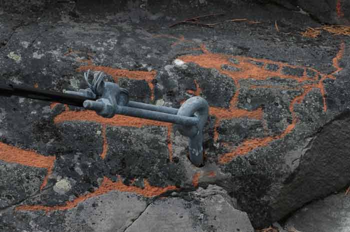
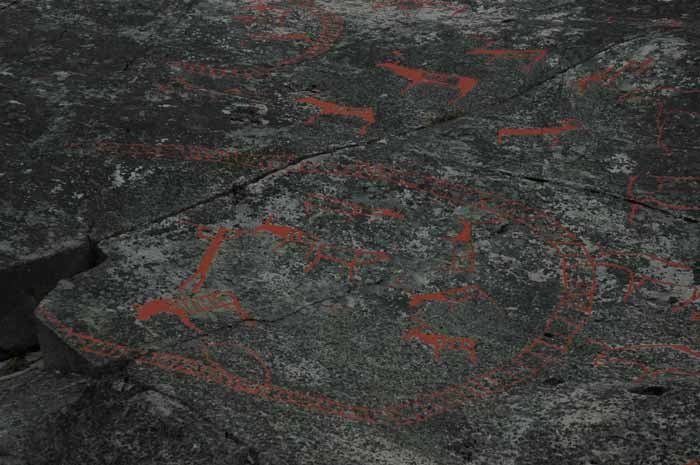
Stop 10 is also part of Phase I and has in interesting feature. Before the carvings were discovered, a metal bolt had been hammered into the rock to hold a wire stay to brace a high-voltage pole. It is located in the center of a reindeer herd. The figures were only discovered when someone, many years later, took hold of the stay and pulled themselves up the rock. This gives an indication of how hard it is to spot these rock carvings without the red dye that has been used to bring them out for visitors to view them. There are also a number of interesting human figures here.
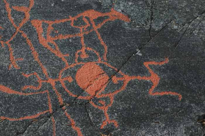
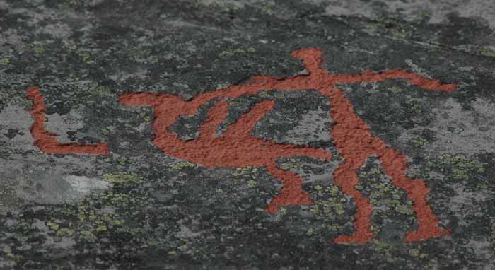
Stop 11 continues with Phase I carvings and contains some of the most unusual figures, all jumbled up close to one another. It is is hard to pick our which ones to focus on. The groups of humans all seem to be doing strange activities or rituals. There is a group of nine that seem to be moving together. There is also this is a group of four holding some object (the guide book offers up the sun, the moon or maybe even an egg). One figure is of a squatting woman that may be giving birth.
Stop 12 consists of newer carvings dating to about 3,200 to 2,600 years ago (Phase IVA).
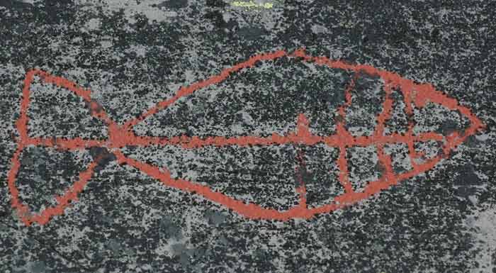
Stop 13, also the same phase as Stop 12, has a very interesting large halibut. This is the only fish portrayed in the rock carvings.
Stop 14 is the last on the trail and is also the youngest, with the carvings made about 2,600 to 2,000 years ago. The scene contains boats that are of a type previously only found much further south in Norway.
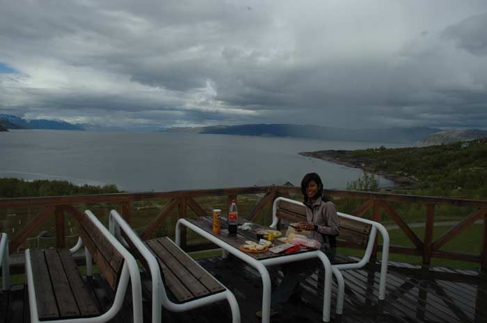
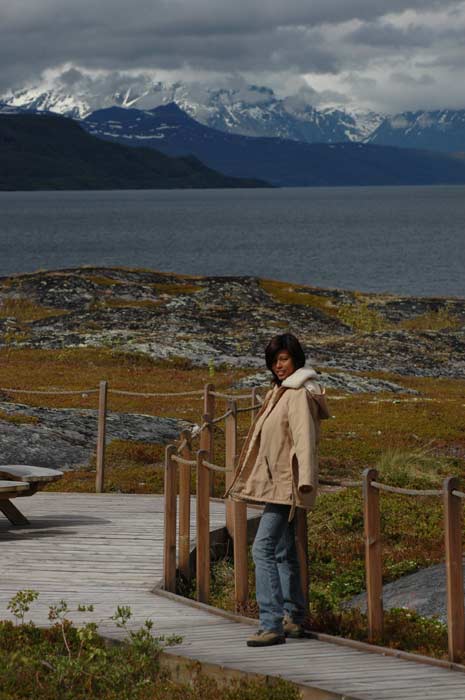
We now make our way back up to the museum and decide it is time for lunch. But we must first head out to the local supermarket to get some supplies. Once back at the museum, we take advantage of one of their many picnic tables to have our lunch overlooking the fjord. It is a great spot.
After lunch we finish looking at the rest of the museum and then head on. It is almost four in the afternoon and we have to make some progress. We head west out of Alta, heading around the small Kåfjord that extends in from the larger Altafjord. The Kåfjord church dates back to 1836 and its origins and history are closely linked to the now defunct copper mines. The fjord is also known as the hiding place of the world's largest battleship, the Tirpitz, which the Germans tried to hide in amongst the tall mountains that surround the fjord. It was, however, hit and sunk by bombs.
We now leave Finnmark and enter Tromso. We drive along Langfjord - and it certainly is long, extending in a straight, narrow line from the Altafjord. At the end of the fjord, we turn west again and make our way to Saltnes.
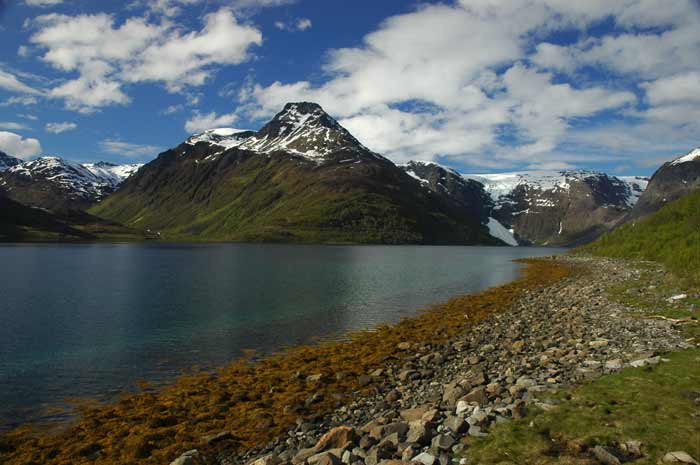
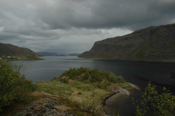
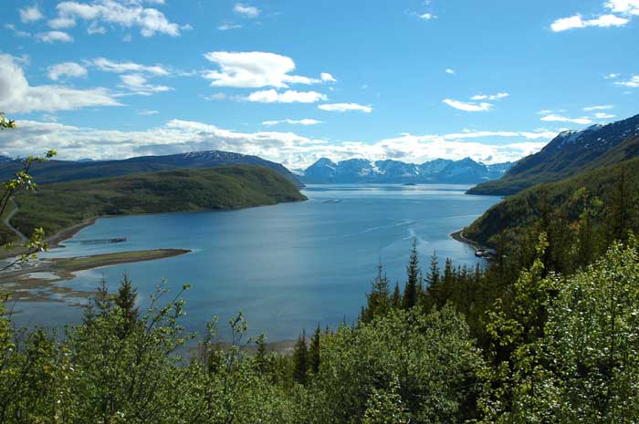
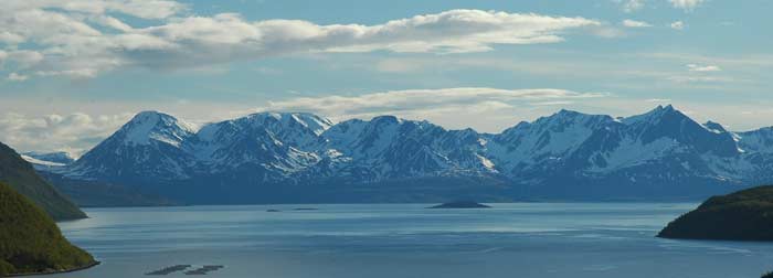
At Saltnes, more a location rather than a town, on Jøkelfjord, we walk a short distance along a trail to get a wonderful view of the fjord and the Øksfjord Glacier, Norway's fifth biggest icecap and the only one that calves into the sea. One can walk for a few hours up to the base of the glacier where it calves into the sea, but we decided to enjoy the view and the weather and just sit back and relax.
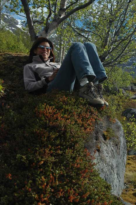
We brought along some snacks and our triple flask for a wee dram. We spend over an hour just laying back here soaking it all up. It is warm, the sky is almost clear of clouds and the ground beneath is is covered with thick, soft moss that makes a wonderful resting spot.
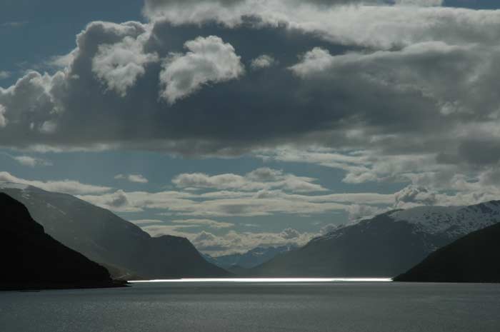
At around 7 PM we decide that it is time to head on and look for a place to spend the night. We end up driving for about another hour and a half. We make our way back to the E6 and head southwest. We pass between the inner and outer Kvænangen over the three hundred meter bridge over the Sørstraumen, a strong tidal current that small boats cannot handle when it is running at top speed.
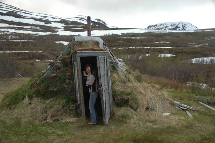
We now begin the drive up the cliff side to the highest point on this section of the road at 402 meters on the Mount Kvænanggsfjell. The weather is starting to close in, so we hope to get up there to enjoy the view before it gets too cloudy. As we have seen, the weather can change very suddenly, for the better or worse, in this country. Along the way up the winding road to the stop we stop at some Kautonkeino Sámi turf huts. In is a wonderful spot for this huts, with the majestic Kvænang peaks in the background, and the sea below. The huts are unoccupied at the moment, and they seem pretty run down. But they could be made very comfortable in a jiffy and would make a nice refuge in a storm.
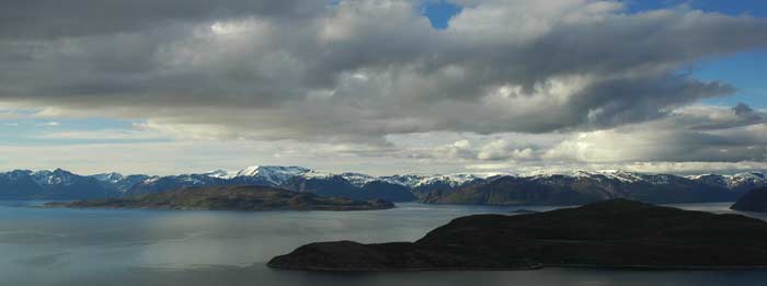
We also pass along the way the snow fences and structures that were build by Norwegian prisoners held at a German prison camp here during the Second World War. At around 8 PM we arrive at the highest point on the road and stop at a hotel situated here. We first take our pictures of the stunning view down into the sea below, with the mountain peaks and Øksfjord Glacier in the mid-ground. As we are here, we decide to enquire about the huts that the hotel seems to have available. But they are well over-priced and very arrogant about it. The guy working behind the counter says with a sniff, and a nose in the air, that this is not a camp site. Well, time to move on.
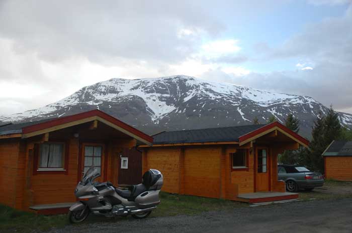
Around 30 minutes later we find a decent small campsite along the edge of a branch of the Reisafjord that has a cabin available. We are able to borrow a few pots, so dinner can be cooked. Our cabin is decent - two rooms with four beds. We cook and eat in the outer room and sleep in the inner room. After our usual one pot dinner, we take it easy and work on our journals.