Our objective today is to hike to the true north of Norway and Europe. While all the tourist materials and signs say that the Nordkapp is the northern most point, this is not true. The northernmost point can only be reached by foot, and not by car. We do have a bit of a slow start to the day, lazing around for most of the morning. But we did have a long day yesterday. And we have all day and night to do the walk, so it does not really matter.
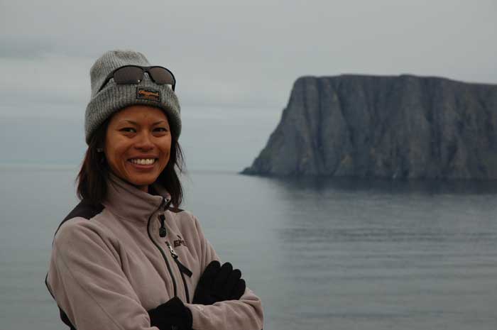
We have our breakfast and then prepare our picnic lunch that we will eat along the trail. We pack our bags - water, food, raincoats, hats and gloves, rain covers and camera equipment, and are ready to go. The trailhead is a short drive away - on the way to the Nordkapp. We park our car and we begin our walk shortly before 1 PM.
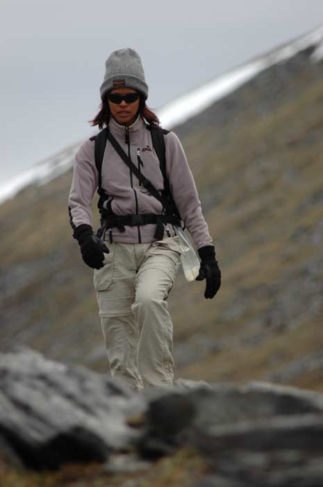
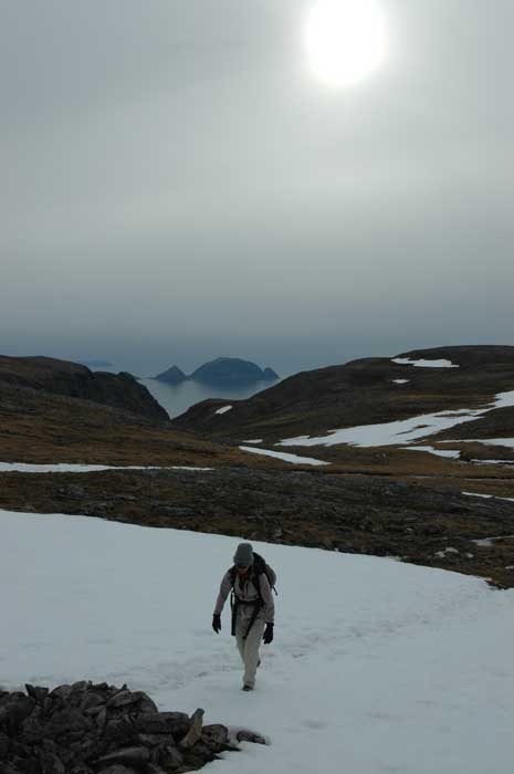
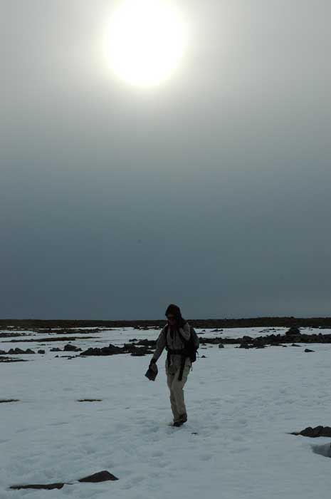
It is a fun walk - not too much up and down, except for the last stretch when we have to make our way down to sea level. The toughest parts are the lose rocks that cover extensive parts of the trail (typically Norwegian hiking) and the water logged nature of the ground. The heavy snow cover that covered this area just a short while ago (there is still snow in sections) has melted and the ground is still trying to absorb all this water.
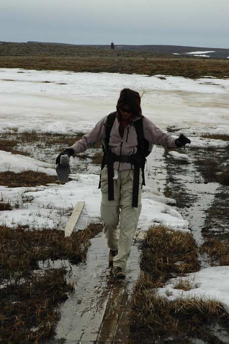
Some sections of the trail have been covered with raised planks that we walk along while trying to keep our balance. Sometimes our weight forces the planks to sink down and the water flows over - we cannot afford to stand in one place to long if we do not want to get our boots too weight. In other spots we have to hop from rock to rock or from raised clump of dirt to another, small islands in the waterlogged earth.
Often the remaining fields of snow are the easiest way to go, but the snow is very wet and the water is slowly soaking through our boots (which have not been treated as recently as they should have). And we have to be careful to not crash through a layer of snow to a stream or pond below. It can be deceptive. Jacqui sends Lars ahead - if he can make it with his heavier weight, then it should not be a problem for her!!!!
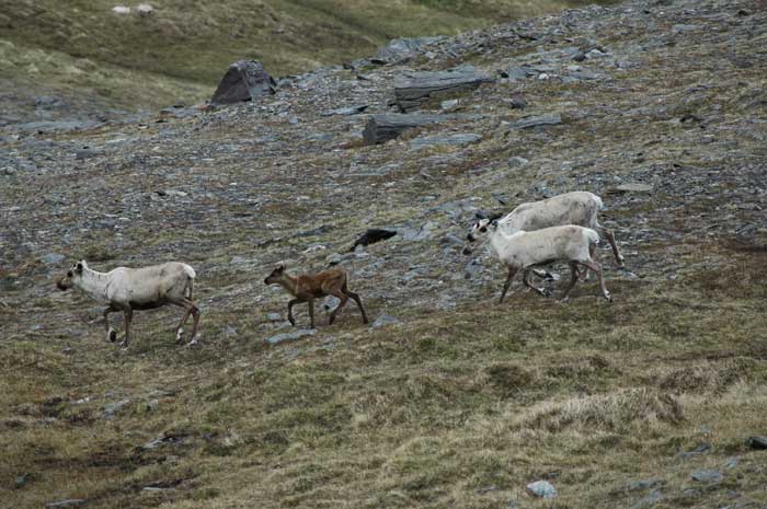
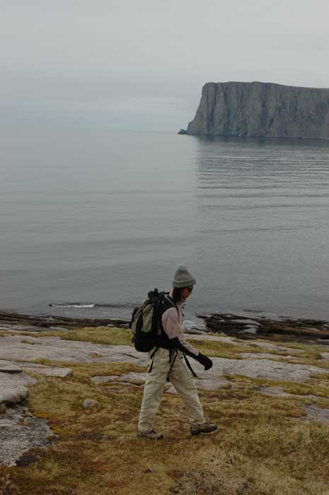
The one other dampener on the walk is the weather. The cloud cover does not seem like it will lift; in fact, it threatens to rain the whole time. But the scenery is still stunning and we enjoy the walk. Along the way, we come upon a herd of reindeer grazing on the rich grass. But they are skittish and do not let us come very close. Soon we are at the steep section - where we have to take a windy trail down to the shoreline below. On our left (or west side) is the knife edge ridge that runs the length of the peninsula. On our right, or east side, is the bay that separates us from the Nordkapp.
Once we have reached the bottom, the walk along this section is actually the most difficult. The trail slopes from left to right and is often located on the smooth, wet rock. I is uncomfortable to walk on. But at least it is not waterlogged. It takes us almost three hours, but we finally reach the northernmost point in Norway and Europe. There is another couple already there - they are elderly and we are impressed with their achievement.
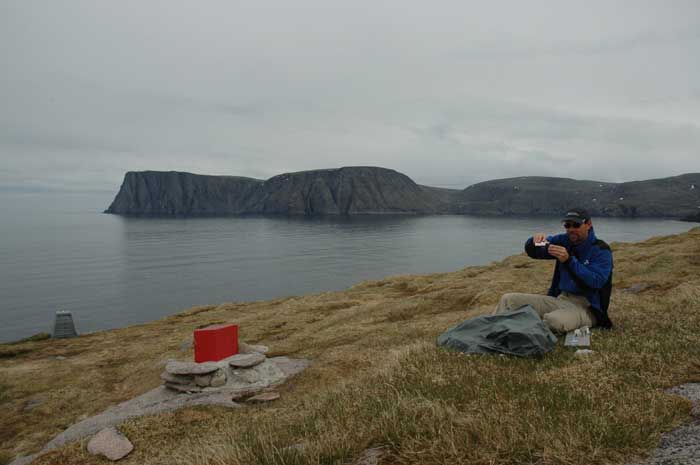
They have a couple of planks laid out as benches with a marker to mark the spot. There is also a box with a guest book, where we can sign in. But first, it is time for lunch. We take out our lunch and enjoy our break as we look east towards the 300 meter high cliffs that form the Nordkapp and the Nordkapp plateau. One could see why the early explorers had mistakenly chosen that much more dramatic spot as the northernmost point.
As we are eating our lunch, a few rain drops fall. But we are fortunate, it does not last long. We now take the time to fill out the visitors book. We notice that so far this year, or at least this summer, we are visitors number 16 and 17. It does feel good, much better than driving up to the Nordkapp, to have reached this point on foot. A select few who have taken the extra time and effort to walk out here. It is a rewarding walk.
Then it is soon time to head back. The walk back along the side-ways sloping terrace to the base of the cliff does not seem to take so long this time. Then we begin the steep climb back up to the top of the plateau. despite the cold, we are working up a sweat and have stripped down to our bottom layer. We catch up to the elderly couple here. But while they are going slowly, they are making steady progress. Very impressive.
We retrace our steps back along the trail. Along the way, we once again see reindeer. We also see some Arctic birds, including the Golden Plover and the Arctic Skua.
We make our way across the water soaked sections, cross the many steams that cut through the trail and traverse the remaining snowfields. Once again we spot the bright block of white stone that from a distance looks like a huge block of snow. The sun begins to shine brighter through the clouds - it is finding thinner patches of clouds that it is struggling to penetrate.
We return to our car shortly after 7 PM, pleased to have completed the walk. Just as we are arriving, two men are just leaving on their walk. We load up our stuff and are soon on our way back to our cabin. We decide to take it easy for the rest of the evening, just having dinner in our cabin and relaxing after our day of exercise.